Chocontá geodata
Chocontá (Cundinamarca) is a seat of a second-order administrative division; located in Colombia in America/Bogota (GMT-5) time zone. With population of 7,592 people, there are 385 cities with bigger population in this country. Compared to other cities in Colombia, 58.4% of cities are located further ↑North; 71.9% of cities are located further ←West and 94.7% of cities have lower elevation than Chocontá. Note1


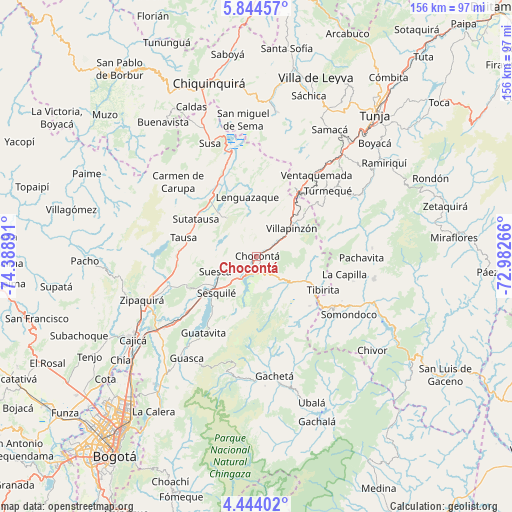
Chocontá GPS coordinates[2]
5° 8' 40.848" North, 73° 41' 8.808" West
| Map corner | latitude | longitude |
|---|---|---|
| Upper-left | 5.84457°, | -74.38891° |
| Center: | 5.14468°, | -73.68578° |
| Lower-right: | 4.44402°, | -72.98266° |
| Map W x H: | 155.7×155.7 km | = 96.7×96.7mi |
| max Lat: | 13.38166° ⇑58.4% North |
| Chocontá: | 5.14468° |
| min Lat: | ⇓41.6% South -4.21528° |
| min Long | Chocontá | max Long |
| -81.70636° | -73.68578° | -67.06996° |
| W 71.9%⇐ | ⇒28.1% E |
Elevation
Elevation of Chocontá is 2656 m = 8714 ft, and this is 1506.7 m = 4943 ft above average elevation for this country.
| Max E: |
3342 m = 10965 ft | 5.3% |
| Chocontá | 2656 m 8714 ft | |
| Avg. | 1149.3 m = 3771 ft | |
Min E: |
1 m = 3 ft | 94.7% |
See also: Colombia elevation on elevation.city.
Geographical zone
Chocontá is located in North Torrid zone (between Equator and Tropic of Cancer). Distance of Equator is 572 km =355.4 mi to South.| Distance of | km | miles | from Chocontá |
|---|---|---|---|
| North Pole | 9435 | 5862.6 | to North |
| Arctic Circle | 6829.1 | 4243.4 | to North |
| Tropic Cancer | 2033.9 | 1263.8 | to North |
| Equator | 572 | 355.4 | to South |


Nearby cities:
15 places around Chocontá: (largest is in red/bold)
• Cucunubá
14.7 km =9.1 mi,  322°
322°
• Gachancipá
26.7 km =16.6 mi,  230°
230°
• Guachetá
26.6 km =16.5 mi,  359°
359°
• Lenguazaque
18.3 km =11.4 mi,  351°
351°
• Machetá
11.1 km =6.9 mi,  129°
129°
• Manta
22 km =13.7 mi, 133°
• Nemocón
22.9 km =14.2 mi,  248°
248°
• Sesquilé
16.6 km =10.3 mi, 227°
• Suesca
13.3 km =8.3 mi, 249°
• Sutatausa
21.7 km =13.5 mi,  301°
301°
• Tausa
23.5 km =14.6 mi,  284°
284°
• Tibirita
22.5 km =14 mi,  117°
117°
• Villa de San Diego de Ubaté
23.3 km =14.5 mi, 321°
• Villapinzón
12.8 km =8 mi,  51°
51°
• Úmbita
26.7 km =16.6 mi,  71°
71°
Sources, notices
• [Note1] Compared only with cities in Colombia existing in our database
• [Src1] Map data: © OpenStreetMap contributors (CC-BY-SA)
• [Src2] Other city data from geonames.org with taken over terms of usage.
• [Src3] Geographical zone / Annual Mean Temperature by Robert A. Rohde @ Wikipedia
