Lenguazaque geodata
Lenguazaque (Cundinamarca) is a seat of a second-order administrative division; located in Colombia in America/Bogota (GMT-5) time zone. With population of 2,555 people, there are 734 cities with bigger population in this country. Compared to other cities in Colombia, 54.7% of cities are located further ↑North; 71.3% of cities are located further ←West and 91.7% of cities have lower elevation than Lenguazaque. Note1


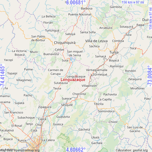
Lenguazaque GPS coordinates[2]
5° 18' 25.596" North, 73° 42' 41.472" West
| Map corner | latitude | longitude |
|---|---|---|
| Upper-left | 6.00681°, | -74.41465° |
| Center: | 5.30711°, | -73.71152° |
| Lower-right: | 4.60662°, | -73.0084° |
| Map W x H: | 155.7×155.7 km | = 96.7×96.7mi |
| max Lat: | 13.38166° ⇑54.7% North |
| Lenguazaque: | 5.30711° |
| min Lat: | ⇓45.3% South -4.21528° |
| min Long | Lenguazaque | max Long |
| -81.70636° | -73.71152° | -67.06996° |
| W 71.3%⇐ | ⇒28.7% E |
Elevation
Elevation of Lenguazaque is 2577 m = 8455 ft, and this is 1427.7 m = 4684 ft above average elevation for this country.
| Max E: |
3342 m = 10965 ft | 8.3% |
| Lenguazaque | 2577 m 8455 ft | |
| Avg. | 1149.3 m = 3771 ft | |
Min E: |
1 m = 3 ft | 91.7% |
See also: Colombia elevation on elevation.city.
Geographical zone
Lenguazaque is located in North Torrid zone (between Equator and Tropic of Cancer). Distance of Equator is 590.1 km =366.7 mi to South.| Distance of | km | miles | from Lenguazaque |
|---|---|---|---|
| North Pole | 9417 | 5851.5 | to North |
| Arctic Circle | 6811.1 | 4232.2 | to North |
| Tropic Cancer | 2015.8 | 1252.6 | to North |
| Equator | 590.1 | 366.7 | to South |


Nearby cities:
15 places around Lenguazaque: (largest is in red/bold)
• Carmen de Carupa
21.6 km =13.4 mi,  282°
282°
• Chocontá
18.3 km =11.4 mi,  171°
171°
• Cucunubá
8.8 km =5.5 mi,  223°
223°
• Fúquene
14.3 km =8.9 mi,  318°
318°
• Guachetá
9 km =5.6 mi,  18°
18°
• La Mesa
23.2 km =14.4 mi,  258°
258°
• San Miguel de Sema
23.5 km =14.6 mi,  357°
357°
• Suesca
24.7 km =15.3 mi,  202°
202°
• Susa
19.7 km =12.2 mi, 324°
• Sutatausa
16.9 km =10.5 mi,  247°
247°
• Tausa
23.3 km =14.5 mi,  238°
238°
• Turmequé
24.5 km =15.2 mi,  85°
85°
• Ventaquemada
22.2 km =13.8 mi,  72°
72°
• Villa de San Diego de Ubaté
11.5 km =7.1 mi,  271°
271°
• Villapinzón
16.4 km =10.2 mi,  128°
128°
Sources, notices
• [Note1] Compared only with cities in Colombia existing in our database
• [Src1] Map data: © OpenStreetMap contributors (CC-BY-SA)
• [Src2] Other city data from geonames.org with taken over terms of usage.
• [Src3] Geographical zone / Annual Mean Temperature by Robert A. Rohde @ Wikipedia
