Subachoque geodata
Subachoque (Cundinamarca) is a seat of a second-order administrative division; located in Colombia in America/Bogota (GMT-5) time zone. With population of 4,088 people, there are 577 cities with bigger population in this country. Compared to other cities in Colombia, 63.8% of cities are located further ↑North; 62.4% of cities are located further ←West and 94.6% of cities have lower elevation than Subachoque. Note1


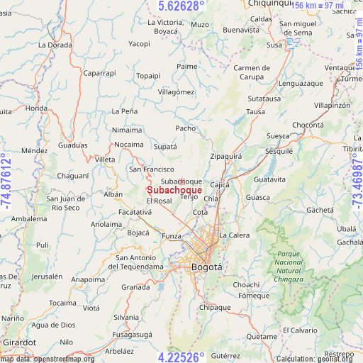
Subachoque GPS coordinates[2]
4° 55' 34.104" North, 74° 10' 22.764" West
| Map corner | latitude | longitude |
|---|---|---|
| Upper-left | 5.62628°, | -74.87612° |
| Center: | 4.92614°, | -74.17299° |
| Lower-right: | 4.22526°, | -73.46987° |
| Map W x H: | 155.8×155.8 km | = 96.8×96.8mi |
| max Lat: | 13.38166° ⇑63.8% North |
| Subachoque: | 4.92614° |
| min Lat: | ⇓36.2% South -4.21528° |
| min Long | Subachoque | max Long |
| -81.70636° | -74.17299° | -67.06996° |
| W 62.4%⇐ | ⇒37.6% E |
Elevation
Elevation of Subachoque is 2651 m = 8698 ft, and this is 1501.7 m = 4927 ft above average elevation for this country.
| Max E: |
3342 m = 10965 ft | 5.4% |
| Subachoque | 2651 m 8698 ft | |
| Avg. | 1149.3 m = 3771 ft | |
Min E: |
1 m = 3 ft | 94.6% |
See also: Colombia elevation on elevation.city.
Geographical zone
Subachoque is located in North Torrid zone (between Equator and Tropic of Cancer). Distance of Equator is 547.7 km =340.3 mi to South.| Distance of | km | miles | from Subachoque |
|---|---|---|---|
| North Pole | 9459.3 | 5877.7 | to North |
| Arctic Circle | 6853.4 | 4258.5 | to North |
| Tropic Cancer | 2058.2 | 1278.9 | to North |
| Equator | 547.7 | 340.3 | to South |


Nearby cities:
15 places around Subachoque: (largest is in red/bold)
• Cajicá
16.1 km =10 mi,  92°
92°
• Chía
14.7 km =9.1 mi,  120°
120°
• Cota
15.4 km =9.6 mi,  147°
147°
• El Rosal
12.6 km =7.8 mi,  229°
229°
• Facatativá
23.7 km =14.7 mi,  238°
238°
• Funza
23.7 km =14.7 mi,  190°
190°
• La Vega
20.5 km =12.7 mi,  294°
294°
• Madrid
23.8 km =14.8 mi,  205°
205°
• Mosquera
25.3 km =15.7 mi, 194°
• Pacho
23 km =14.3 mi,  3°
3°
• San Francisco
14.5 km =9 mi, 293°
• Supatá
16.6 km =10.3 mi,  334°
334°
• Tabio
8.8 km =5.5 mi,  96°
96°
• Tenjo
6.7 km =4.2 mi, 151°
• Zipaquirá
21.5 km =13.4 mi,  60°
60°
Sources, notices
• [Note1] Compared only with cities in Colombia existing in our database
• [Src1] Map data: © OpenStreetMap contributors (CC-BY-SA)
• [Src2] Other city data from geonames.org with taken over terms of usage.
• [Src3] Geographical zone / Annual Mean Temperature by Robert A. Rohde @ Wikipedia
