La Vega geodata
La Vega (Cundinamarca) is a populated place; located in Colombia in America/Bogota (GMT-5) time zone. With population of 5,706 people, there are 464 cities with bigger population in this country. Compared to other cities in Colombia, 62.3% of cities are located further ↑North; 59.8% of cities are located further ←West and 50.6% of cities have lower elevation than La Vega. Note1


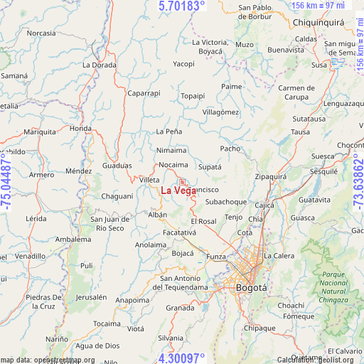
La Vega GPS coordinates[2]
5° 0' 6.372" North, 74° 20' 30.264" West
| Map corner | latitude | longitude |
|---|---|---|
| Upper-left | 5.70183°, | -75.04487° |
| Center: | 5.00177°, | -74.34174° |
| Lower-right: | 4.30097°, | -73.63862° |
| Map W x H: | 155.8×155.8 km | = 96.8×96.8mi |
| max Lat: | 13.38166° ⇑62.3% North |
| La Vega: | 5.00177° |
| min Lat: | ⇓37.7% South -4.21528° |
| min Long | La Vega | max Long |
| -81.70636° | -74.34174° | -67.06996° |
| W 59.8%⇐ | ⇒40.2% E |
Elevation
Elevation of La Vega is 1141 m = 3743 ft, and this is 8.3 m = 27 ft below average elevation for this country.
| Max E: |
3342 m = 10965 ft | 49.4% |
| Avg. | 1149.3 m = 3771 ft | |
| La Vega | 1141 m = 3743 ft | |
Min E: |
1 m = 3 ft | 50.6% |
See also: Colombia elevation on elevation.city.
Geographical zone
La Vega is located in North Torrid zone (between Equator and Tropic of Cancer). Distance of Equator is 556.1 km =345.5 mi to South.| Distance of | km | miles | from La Vega |
|---|---|---|---|
| North Pole | 9450.9 | 5872.5 | to North |
| Arctic Circle | 6845 | 4253.3 | to North |
| Tropic Cancer | 2049.8 | 1273.7 | to North |
| Equator | 556.1 | 345.5 | to South |


Nearby cities:
15 places around La Vega: (largest is in red/bold)
• Albán
17.5 km =10.9 mi,  217°
217°
• El Rosal
18.8 km =11.7 mi,  151°
151°
• Facatativá
21 km =13 mi,  183°
183°
• Guayabal de Síquima
19.6 km =12.2 mi,  225°
225°
• La Peña
22.6 km =14 mi,  345°
345°
• Nimaima
14.6 km =9.1 mi,  340°
340°
• Nocaima
8.7 km =5.4 mi,  326°
326°
• Pacho
24.9 km =15.5 mi,  54°
54°
• Quebradanegra
19.9 km =12.4 mi,  310°
310°
• San Francisco
6 km =3.7 mi,  115°
115°
• Sasaima
11 km =6.8 mi,  249°
249°
• Subachoque
20.5 km =12.7 mi,  114°
114°
• Supatá
13.3 km =8.3 mi,  60°
60°
• Vergara
13 km =8.1 mi,  358°
358°
• Villeta
14.5 km =9 mi,  273°
273°
Sources, notices
• [Note1] Compared only with cities in Colombia existing in our database
• [Src1] Map data: © OpenStreetMap contributors (CC-BY-SA)
• [Src2] Other city data from geonames.org with taken over terms of usage.
• [Src3] Geographical zone / Annual Mean Temperature by Robert A. Rohde @ Wikipedia
