San Onofre geodata
San Onofre (Sucre) is a seat of a second-order administrative division; located in Colombia in America/Bogota (GMT-5) time zone. With population of 32,957 people, there are 113 cities with bigger population in this country. Compared to other cities in Colombia, 91.8% of cities are located further ↓South; 67.2% of cities are located further →East and 88.5% of cities have higher elevation than San Onofre. Note1


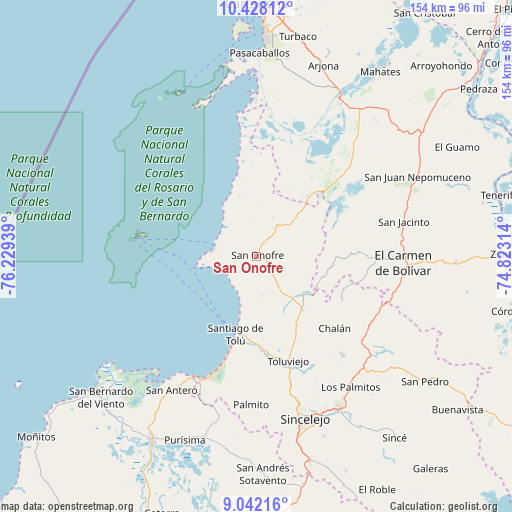
San Onofre GPS coordinates[2]
9° 44' 9.096" North, 75° 31' 34.536" West
| Map corner | latitude | longitude |
|---|---|---|
| Upper-left | 10.42812°, | -76.22939° |
| Center: | 9.73586°, | -75.52626° |
| Lower-right: | 9.04216°, | -74.82314° |
| Map W x H: | 154.1×154.1 km | = 95.8×95.8mi |
| max Lat: | 13.38166° ⇑8.2% North |
| San Onofre: | 9.73586° |
| min Lat: | ⇓91.8% South -4.21528° |
| min Long | San Onofre | max Long |
| -81.70636° | -75.52626° | -67.06996° |
| W 32.8%⇐ | ⇒67.2% E |
Elevation
Elevation of San Onofre is 37 m = 121 ft, and this is 1112.3 m = 3649 ft below average elevation for this country.
| Max E: |
3342 m = 10965 ft | 88.5% |
| Avg. | 1149.3 m = 3771 ft | |
| San Onofre | 37 m = 121 ft | |
Min E: |
1 m = 3 ft | 11.5% |
See also: Colombia elevation on elevation.city.
Geographical zone
San Onofre is located in North Torrid zone (between Equator and Tropic of Cancer). Distance of Equator is 1082.5 km =672.6 mi to South.| Distance of | km | miles | from San Onofre |
|---|---|---|---|
| North Pole | 8924.5 | 5545.4 | to North |
| Arctic Circle | 6318.6 | 3926.2 | to North |
| Tropic Cancer | 1523.4 | 946.6 | to North |
| Equator | 1082.5 | 672.6 | to South |


Nearby cities:
15 places around San Onofre: (largest is in red/bold)
• Chalán
31.5 km =19.6 mi,  131°
131°
• Colosó
32.9 km =20.4 mi,  144°
144°
• Coveñas
40.7 km =25.3 mi,  204°
204°
• El Carmen de Bolívar
44.5 km =27.7 mi,  92°
92°
• Los Palmitos
48.8 km =30.3 mi, 144°
• María la Baja
36.9 km =22.9 mi,  41°
41°
• Ovejas
40 km =24.9 mi, 125°
• Palmito
44.9 km =27.9 mi,  182°
182°
• San Antero
47.6 km =29.6 mi,  212°
212°
• San Cristóbal
33.9 km =21.1 mi,  62°
62°
• San Jacinto
45.5 km =28.3 mi,  77°
77°
• San Pablo
45.1 km =28 mi, 38°
• Santiago de Tolú
24.3 km =15.1 mi,  194°
194°
• Sincelejo
50 km =31.1 mi,  163°
163°
• Tolú Viejo
33.1 km =20.6 mi, 163°
Sources, notices
• [Note1] Compared only with cities in Colombia existing in our database
• [Src1] Map data: © OpenStreetMap contributors (CC-BY-SA)
• [Src2] Other city data from geonames.org with taken over terms of usage.
• [Src3] Geographical zone / Annual Mean Temperature by Robert A. Rohde @ Wikipedia
