San Antonio del Tequendama geodata
San Antonio del Tequendama (Cundinamarca) is a seat of a second-order administrative division; located in Colombia in America/Bogota (GMT-5) time zone. With population of 1,020 people, there are 947 cities with bigger population in this country. Compared to other cities in Colombia, 69.5% of cities are located further ↑North; 59.5% of cities are located further ←West and 62.5% of cities have lower elevation than San Antonio del Tequendama. Note1
Current local time in San Antonio del Tequendama:
09:35 AM, WednesdayDifference from your time zone: hours


San Antonio del Tequendama GPS coordinates[2]
4° 36' 58.212" North, 74° 21' 7.2" West
| Map corner | latitude | longitude |
|---|---|---|
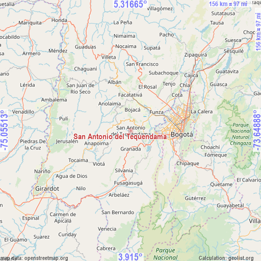
| Upper-left | 5.31665°, | -75.05513° |
| Center: | 4.61617°, | -74.352° |
| Lower-right: | 3.915°, | -73.64888° |
| Map W x H: | 155.8×155.9 km | = 96.8×96.9mi |
| max Lat: | 13.38166° ⇑69.5% North |
| San Antonio del Tequendama: | 4.61617° |
| min Lat: | ⇓30.5% South -4.21528° |
| min Long | San Antonio del | max Long |
| -81.70636° | -74.352° | -67.06996° |
| W 59.5%⇐ | ⇒40.5% E |
Elevation
Elevation of San Antonio del Tequendama is 1541 m = 5056 ft, and this is 391.7 m = 1285 ft above average elevation for this country.
| Max E: |
3342 m = 10965 ft | 37.5% |
| San Antonio del Tequendama | 1541 m 5056 ft | |
| Avg. | 1149.3 m = 3771 ft | |
Min E: |
1 m = 3 ft | 62.5% |
See also: Colombia elevation on elevation.city.
Geographical zone
San Antonio del Tequendama is located in North Torrid zone (between Equator and Tropic of Cancer). Distance of Equator is 513.3 km =318.9 mi to South.| Distance of | km | miles | from San Antonio del Tequendama |
|---|---|---|---|
| North Pole | 9493.8 | 5899.2 | to North |
| Arctic Circle | 6887.9 | 4279.9 | to North |
| Tropic Cancer | 2092.6 | 1300.3 | to North |
| Equator | 513.3 | 318.9 | to South |


Nearby cities:
15 places around San Antonio del Tequendama: (largest is in red/bold)
• Anapoima
21.6 km =13.4 mi,  250°
250°
• Bojacá
12.9 km =8 mi,  5°
5°
• Cachipay
15.8 km =9.8 mi,  323°
323°
• El Colegio
10.8 km =6.7 mi, 248°
• Facatativá
22 km =13.7 mi,  359°
359°
• Funza
19.1 km =11.9 mi,  54°
54°
• Granada
10.7 km =6.6 mi,  180°
180°
• Madrid
16.2 km =10.1 mi,  36°
36°
• Mosquera
16.8 km =10.4 mi, 53°
• Quipile
24.7 km =15.3 mi,  305°
305°
• Sibaté
17.2 km =10.7 mi,  143°
143°
• Silvania
23.9 km =14.9 mi,  189°
189°
• Soacha
15.5 km =9.6 mi,  105°
105°
• Tena
6.6 km =4.1 mi, 317°
• Zipacón
16.2 km =10.1 mi,  348°
348°
Sources, notices
• [Note1] Compared only with cities in Colombia existing in our database
• [Src1] Map data: © OpenStreetMap contributors (CC-BY-SA)
• [Src2] Other city data from geonames.org with taken over terms of usage.
• [Src3] Geographical zone / Annual Mean Temperature by Robert A. Rohde @ Wikipedia
