Pie de Pató geodata
Pie de Pató (Chocó) is a seat of a second-order administrative division; located in Colombia in America/Bogota (GMT-5) time zone. With population of 3,242 people, there are 662 cities with bigger population in this country. Compared to other cities in Colombia, 50.3% of cities are located further ↑North; 92.3% of cities are located further →East and 92.4% of cities have higher elevation than Pie de Pató. Note1


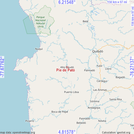
Pie de Pató GPS coordinates[2]
5° 30' 57.744" North, 76° 58' 28.164" West
| Map corner | latitude | longitude |
|---|---|---|
| Upper-left | 6.21548°, | -77.67762° |
| Center: | 5.51604°, | -76.97449° |
| Lower-right: | 4.81578°, | -76.27137° |
| Map W x H: | 155.6×155.6 km | = 96.7×96.7mi |
| max Lat: | 13.38166° ⇑50.3% North |
| Pie de Pató: | 5.51604° |
| min Lat: | ⇓49.7% South -4.21528° |
| min Long | Pie de Pató | max Long |
| -81.70636° | -76.97449° | -67.06996° |
| W 7.7%⇐ | ⇒92.3% E |
Elevation
Elevation of Pie de Pató is 21 m = 69 ft, and this is 1128.3 m = 3702 ft below average elevation for this country.
| Max E: |
3342 m = 10965 ft | 92.4% |
| Avg. | 1149.3 m = 3771 ft | |
| Pie de Pató | 21 m = 69 ft | |
Min E: |
1 m = 3 ft | 7.6% |
See also: Colombia elevation on elevation.city.
Geographical zone
Pie de Pató is located in North Torrid zone (between Equator and Tropic of Cancer). Distance of Equator is 613.3 km =381.1 mi to South.| Distance of | km | miles | from Pie de Pató |
|---|---|---|---|
| North Pole | 9393.7 | 5837 | to North |
| Arctic Circle | 6787.8 | 4217.7 | to North |
| Tropic Cancer | 1992.6 | 1238.1 | to North |
| Equator | 613.3 | 381.1 | to South |


Nearby cities:
15 places around Pie de Pató: (largest is in red/bold)
• Bagadó
63 km =39.1 mi,  100°
100°
• Beté
57.3 km =35.6 mi,  21°
21°
• Condoto
59.2 km =36.8 mi,  142°
142°
• Cértegui
44 km =27.3 mi,  111°
111°
• El Cantón de San Pablo
33.3 km =20.7 mi,  126°
126°
• Istmina
51 km =31.7 mi, 140°
• Lloró
47.1 km =29.3 mi,  92°
92°
• Managrú
33.8 km =21 mi, 126°
• Nuquí
39.4 km =24.5 mi,  303°
303°
• Paimadó
26.2 km =16.3 mi, 98°
• Puerto Meluk
33 km =20.5 mi,  172°
172°
• Quibdó
40.1 km =24.9 mi,  60°
60°
• Tadó
53.2 km =33.1 mi,  121°
121°
• Yuto
37.6 km =23.4 mi, 87°
• Ánimas
46.4 km =28.8 mi, 124°
Sources, notices
• [Note1] Compared only with cities in Colombia existing in our database
• [Src1] Map data: © OpenStreetMap contributors (CC-BY-SA)
• [Src2] Other city data from geonames.org with taken over terms of usage.
• [Src3] Geographical zone / Annual Mean Temperature by Robert A. Rohde @ Wikipedia
