Ocamonte geodata
Ocamonte (Santander) is a seat of a second-order administrative division; located in Colombia in America/Bogota (GMT-5) time zone. With population of 883 people, there are 964 cities with bigger population in this country. Compared to other cities in Colombia, 65.6% of cities are located further ↓South; 84.3% of cities are located further ←West and 58% of cities have lower elevation than Ocamonte. Note1


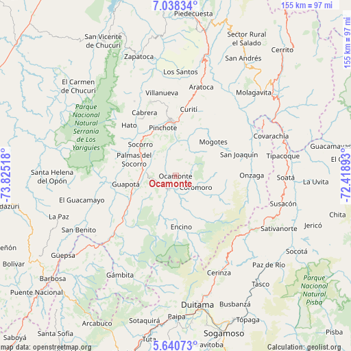
Ocamonte GPS coordinates[2]
6° 20' 24.036" North, 73° 7' 19.38" West
| Map corner | latitude | longitude |
|---|---|---|
| Upper-left | 7.03834°, | -73.82518° |
| Center: | 6.34001°, | -73.12205° |
| Lower-right: | 5.64073°, | -72.41893° |
| Map W x H: | 155.4×155.4 km | = 96.6×96.6mi |
| max Lat: | 13.38166° ⇑34.4% North |
| Ocamonte: | 6.34001° |
| min Lat: | ⇓65.6% South -4.21528° |
| min Long | Ocamonte | max Long |
| -81.70636° | -73.12205° | -67.06996° |
| W 84.3%⇐ | ⇒15.7% E |
Elevation
Elevation of Ocamonte is 1409 m = 4623 ft, and this is 259.7 m = 852 ft above average elevation for this country.
| Max E: |
3342 m = 10965 ft | 42% |
| Ocamonte | 1409 m 4623 ft | |
| Avg. | 1149.3 m = 3771 ft | |
Min E: |
1 m = 3 ft | 58% |
See also: Colombia elevation on elevation.city.
Geographical zone
Ocamonte is located in North Torrid zone (between Equator and Tropic of Cancer). Distance of Equator is 704.9 km =438 mi to South.| Distance of | km | miles | from Ocamonte |
|---|---|---|---|
| North Pole | 9302.1 | 5780.1 | to North |
| Arctic Circle | 6696.2 | 4160.8 | to North |
| Tropic Cancer | 1901 | 1181.2 | to North |
| Equator | 704.9 | 438 | to South |


Nearby cities:
15 places around Ocamonte: (largest is in red/bold)
• Charalá
6.6 km =4.1 mi,  204°
204°
• Chima
27.8 km =17.3 mi,  270°
270°
• Confines
13.3 km =8.3 mi,  277°
277°
• Coromoro
10.4 km =6.5 mi,  119°
119°
• Encino
22.7 km =14.1 mi,  173°
173°
• Guapotá
22.2 km =13.8 mi,  260°
260°
• Mogotes
22.5 km =14 mi,  48°
48°
• Oiba
21.3 km =13.2 mi,  246°
246°
• Palmas del Socorro
19.8 km =12.3 mi,  292°
292°
• Pinchote
22.1 km =13.7 mi,  345°
345°
• Páramo
10 km =6.2 mi,  328°
328°
• San Gil
24.5 km =15.2 mi,  356°
356°
• Simacota
26.4 km =16.4 mi,  295°
295°
• Socorro
20.9 km =13 mi,  313°
313°
• Valle de San José
12.2 km =7.6 mi, 348°
Sources, notices
• [Note1] Compared only with cities in Colombia existing in our database
• [Src1] Map data: © OpenStreetMap contributors (CC-BY-SA)
• [Src2] Other city data from geonames.org with taken over terms of usage.
• [Src3] Geographical zone / Annual Mean Temperature by Robert A. Rohde @ Wikipedia
