Quebradanegra geodata
Quebradanegra (Cundinamarca) is a seat of a second-order administrative division; located in Colombia in America/Bogota (GMT-5) time zone. With population of 753 people, there are 990 cities with bigger population in this country. Compared to other cities in Colombia, 59.1% of cities are located further ↑North; 57.1% of cities are located further ←West and 56.9% of cities have lower elevation than Quebradanegra. Note1


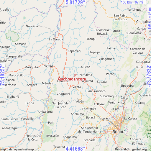
Quebradanegra GPS coordinates[2]
5° 7' 2.532" North, 74° 28' 45.984" West
| Map corner | latitude | longitude |
|---|---|---|
| Upper-left | 5.81729°, | -75.18257° |
| Center: | 5.11737°, | -74.47944° |
| Lower-right: | 4.41668°, | -73.77632° |
| Map W x H: | 155.7×155.7 km | = 96.7×96.7mi |
| max Lat: | 13.38166° ⇑59.1% North |
| Quebradanegra: | 5.11737° |
| min Lat: | ⇓40.9% South -4.21528° |
| min Long | Quebradanegra | max Long |
| -81.70636° | -74.47944° | -67.06996° |
| W 57.1%⇐ | ⇒42.9% E |
Elevation
Elevation of Quebradanegra is 1356 m = 4449 ft, and this is 206.7 m = 678 ft above average elevation for this country.
| Max E: |
3342 m = 10965 ft | 43.1% |
| Quebradanegra | 1356 m 4449 ft | |
| Avg. | 1149.3 m = 3771 ft | |
Min E: |
1 m = 3 ft | 56.9% |
See also: Colombia elevation on elevation.city.
Geographical zone
Quebradanegra is located in North Torrid zone (between Equator and Tropic of Cancer). Distance of Equator is 569 km =353.6 mi to South.| Distance of | km | miles | from Quebradanegra |
|---|---|---|---|
| North Pole | 9438.1 | 5864.6 | to North |
| Arctic Circle | 6832.2 | 4245.3 | to North |
| Tropic Cancer | 2036.9 | 1265.7 | to North |
| Equator | 569 | 353.6 | to South |


Nearby cities:
15 places around Quebradanegra: (largest is in red/bold)
• Cachipay
19.2 km =11.9 mi,  329°
329°
• Caparrapí
25.5 km =15.8 mi,  357°
357°
• Chaguaní
22.7 km =14.1 mi,  213°
213°
• El Peñón
25.8 km =16 mi,  54°
54°
• Granada
11.2 km =7 mi,  239°
239°
• Guaduas
14 km =8.7 mi,  246°
246°
• La Peña
13.1 km =8.1 mi, 46°
• La Vega
19.9 km =12.4 mi,  130°
130°
• Nimaima
10.5 km =6.5 mi,  84°
84°
• Nocaima
11.9 km =7.4 mi,  118°
118°
• San Francisco
25.8 km =16 mi, 126°
• Sasaima
17.4 km =10.8 mi,  163°
163°
• Vergara
14.8 km =9.2 mi,  89°
89°
• Villeta
12.1 km =7.5 mi,  176°
176°
• Útica
7.8 km =4.8 mi, 358°
Sources, notices
• [Note1] Compared only with cities in Colombia existing in our database
• [Src1] Map data: © OpenStreetMap contributors (CC-BY-SA)
• [Src2] Other city data from geonames.org with taken over terms of usage.
• [Src3] Geographical zone / Annual Mean Temperature by Robert A. Rohde @ Wikipedia
