Filadelfia geodata
Filadelfia (Caldas) is a seat of a second-order administrative division; located in Colombia in America/Bogota (GMT-5) time zone. With population of 5,064 people, there are 503 cities with bigger population in this country. Compared to other cities in Colombia, 55.1% of cities are located further ↑North; 68% of cities are located further →East and 64.6% of cities have lower elevation than Filadelfia. Note1


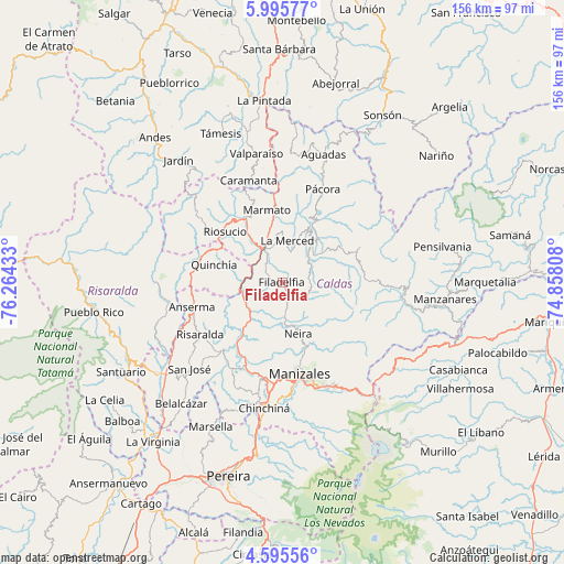
Filadelfia GPS coordinates[2]
5° 17' 45.816" North, 75° 33' 40.32" West
| Map corner | latitude | longitude |
|---|---|---|
| Upper-left | 5.99577°, | -76.26433° |
| Center: | 5.29606°, | -75.5612° |
| Lower-right: | 4.59556°, | -74.85808° |
| Map W x H: | 155.7×155.7 km | = 96.7×96.7mi |
| max Lat: | 13.38166° ⇑55.1% North |
| Filadelfia: | 5.29606° |
| min Lat: | ⇓44.9% South -4.21528° |
| min Long | Filadelfia | max Long |
| -81.70636° | -75.5612° | -67.06996° |
| W 32%⇐ | ⇒68% E |
Elevation
Elevation of Filadelfia is 1584 m = 5197 ft, and this is 434.7 m = 1426 ft above average elevation for this country.
| Max E: |
3342 m = 10965 ft | 35.4% |
| Filadelfia | 1584 m 5197 ft | |
| Avg. | 1149.3 m = 3771 ft | |
Min E: |
1 m = 3 ft | 64.6% |
See also: Colombia elevation on elevation.city.
Geographical zone
Filadelfia is located in North Torrid zone (between Equator and Tropic of Cancer). Distance of Equator is 588.9 km =365.9 mi to South.| Distance of | km | miles | from Filadelfia |
|---|---|---|---|
| North Pole | 9418.2 | 5852.2 | to North |
| Arctic Circle | 6812.3 | 4233 | to North |
| Tropic Cancer | 2017.1 | 1253.4 | to North |
| Equator | 588.9 | 365.9 | to South |


Nearby cities:
15 places around Filadelfia: (largest is in red/bold)
• Anserma
25.7 km =16 mi,  254°
254°
• Anserma
25.8 km =16 mi,  279°
279°
• Aranzazu
8.3 km =5.2 mi,  109°
109°
• Guática
26.3 km =16.3 mi,  274°
274°
• La Merced
11.6 km =7.2 mi,  7°
7°
• Manizales
25.7 km =16 mi,  169°
169°
• Marmato
20.4 km =12.7 mi,  347°
347°
• Neira
15.1 km =9.4 mi,  162°
162°
• Pácora
28.1 km =17.5 mi,  23°
23°
• Quinchía
19.3 km =12 mi, 284°
• Riosucio
21 km =13 mi,  311°
311°
• Risaralda
26.9 km =16.7 mi,  237°
237°
• Salamina
14.8 km =9.2 mi,  33°
33°
• Supía
20.1 km =12.5 mi,  330°
330°
• Villamaría
28.3 km =17.6 mi, 169°
Sources, notices
• [Note1] Compared only with cities in Colombia existing in our database
• [Src1] Map data: © OpenStreetMap contributors (CC-BY-SA)
• [Src2] Other city data from geonames.org with taken over terms of usage.
• [Src3] Geographical zone / Annual Mean Temperature by Robert A. Rohde @ Wikipedia
