Envigado geodata
Envigado (Antioquia) is a seat of a second-order administrative division; located in Colombia in America/Bogota (GMT-5) time zone. With population of 163,007 people, there are 29 cities with bigger population in this country. Compared to other cities in Colombia, 62.7% of cities are located further ↓South; 68.7% of cities are located further →East and 62.3% of cities have lower elevation than Envigado. Note1


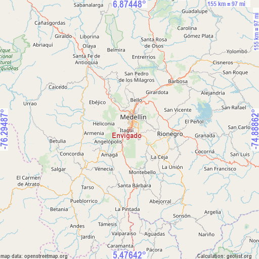
Envigado GPS coordinates[2]
6° 10' 33.276" North, 75° 35' 30.264" West
| Map corner | latitude | longitude |
|---|---|---|
| Upper-left | 6.87448°, | -76.29487° |
| Center: | 6.17591°, | -75.59174° |
| Lower-right: | 5.47642°, | -74.88862° |
| Map W x H: | 155.4×155.5 km | = 96.6×96.6mi |
| max Lat: | 13.38166° ⇑37.3% North |
| Envigado: | 6.17591° |
| min Lat: | ⇓62.7% South -4.21528° |
| min Long | Envigado | max Long |
| -81.70636° | -75.59174° | -67.06996° |
| W 31.3%⇐ | ⇒68.7% E |
Elevation
Elevation of Envigado is 1539 m = 5049 ft, and this is 389.7 m = 1279 ft above average elevation for this country.
| Max E: |
3342 m = 10965 ft | 37.7% |
| Envigado | 1539 m 5049 ft | |
| Avg. | 1149.3 m = 3771 ft | |
Min E: |
1 m = 3 ft | 62.3% |
See also: Envigado elevation on elevation.city.
Geographical zone
Envigado is located in North Torrid zone (between Equator and Tropic of Cancer). Distance of Equator is 686.7 km =426.7 mi to South.| Distance of | km | miles | from Envigado |
|---|---|---|---|
| North Pole | 9320.4 | 5791.4 | to North |
| Arctic Circle | 6714.5 | 4172.2 | to North |
| Tropic Cancer | 1919.2 | 1192.5 | to North |
| Equator | 686.7 | 426.7 | to South |


Nearby cities:
15 places around Envigado: (largest is in red/bold)
• Amagá
19.5 km =12.1 mi,  219°
219°
• Angelópolis
14.9 km =9.3 mi,  240°
240°
• Armenia
21.7 km =13.5 mi,  264°
264°
• Bello
18.3 km =11.4 mi,  11°
11°
• Caldas
10.6 km =6.6 mi,  207°
207°
• Copacabana
21 km =13 mi,  25°
25°
• Guarne
20.1 km =12.5 mi,  54°
54°
• Heliconia
16.3 km =10.1 mi,  282°
282°
• Itagüí
1.3 km =0.8 mi,  319°
319°
• La Ceja
23.8 km =14.8 mi,  132°
132°
• La Estrella
6 km =3.7 mi,  250°
250°
• Medellín
9 km =5.6 mi,  20°
20°
• Retiro
16.3 km =10.1 mi,  143°
143°
• Rionegro
24.2 km =15 mi,  95°
95°
• Sabaneta
3.9 km =2.4 mi,  225°
225°
Sources, notices
• [Note1] Compared only with cities in Colombia existing in our database
• [Src1] Map data: © OpenStreetMap contributors (CC-BY-SA)
• [Src2] Other city data from geonames.org with taken over terms of usage.
• [Src3] Geographical zone / Annual Mean Temperature by Robert A. Rohde @ Wikipedia
