Colón geodata
Colón (Matanzas) is a seat of a second-order administrative division; located in Cuba in America/Havana (GMT-4) time zone. With population of 63,882 people, there are 35 cities with bigger population in this country. Compared to other cities in Cuba, 68% of cities are located further ↓South; 62.4% of cities are located further →East and 56.9% of cities have lower elevation than Colón. Note1


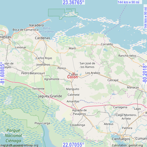
Colón GPS coordinates[2]
22° 43' 14.304" North, 80° 54' 17.712" West
| Map corner | latitude | longitude |
|---|---|---|
| Upper-left | 23.36765°, | -81.60805° |
| Center: | 22.72064°, | -80.90492° |
| Lower-right: | 22.07055°, | -80.2018° |
| Map W x H: | 144.2×144.2 km | = 89.6×89.6mi |
| max Lat: | 23.15917° ⇑32% North |
| Colón: | 22.72064° |
| min Lat: | ⇓68% South 19.90553° |
| min Long | Colón | max Long |
| -84.28599° | -80.90492° | -74.15181° |
| W 37.6%⇐ | ⇒62.4% E |
Elevation
Elevation of Colón is 60 m = 197 ft, and this is 8.6 m = 28 ft below average elevation for this country.
| Max E: |
761 m = 2497 ft | 43.1% |
| Avg. | 68.6 m = 225 ft | |
| Colón | 60 m = 197 ft | |
Min E: |
3 m = 10 ft | 56.9% |
See also: Colón elevation on elevation.city.
Geographical zone
Colón is located in North Torrid zone (between Equator and Tropic of Cancer). Distance of this Northern Tropic circle is 79.6 km =49.5 mi to North.| Distance of | km | miles | from Colón |
|---|---|---|---|
| North Pole | 7480.8 | 4648.4 | to North |
| Arctic Circle | 4874.9 | 3029.1 | to North |
| Tropic Cancer | 79.6 | 49.5 | to North |
| Equator | 2526.3 | 1569.8 | to South |


Nearby cities:
15 places around Colón: (largest is in red/bold)
• Aguada de Pasajeros
37.8 km =23.5 mi,  171°
171°
• Bolondrón
55.9 km =34.7 mi,  274°
274°
• Calimete
20.7 km =12.9 mi,  181°
181°
• Corralillo
43.8 km =27.2 mi,  48°
48°
• Cárdenas
46.7 km =29 mi,  318°
318°
• Jagüey Grande
31.5 km =19.6 mi,  226°
226°
• Jovellanos
30.8 km =19.1 mi,  287°
287°
• Limonar
57.8 km =35.9 mi,  296°
296°
• Los Arabos
18.9 km =11.7 mi,  86°
86°
• Manguito
14.9 km =9.3 mi, 183°
• Martí
25.2 km =15.7 mi,  356°
356°
• Pedro Betancourt
39.5 km =24.5 mi, 271°
• Perico
12.9 km =8 mi, 295°
• Rancho Veloz
55.6 km =34.5 mi,  71°
71°
• Rodas
55.3 km =34.4 mi,  139°
139°
Sources, notices
• [Note1] Compared only with cities in Cuba existing in our database
• [Src1] Map data: © OpenStreetMap contributors (CC-BY-SA)
• [Src2] Other city data from geonames.org with taken over terms of usage.
• [Src3] Geographical zone / Annual Mean Temperature by Robert A. Rohde @ Wikipedia
