Rancho Veloz geodata
Rancho Veloz (Villa Clara) is a populated place; located in Cuba in America/Havana (GMT-4) time zone. With population of 4,549 people, there are 149 cities with bigger population in this country. Compared to other cities in Cuba, 81.8% of cities are located further ↓South; 58% of cities are located further →East and 55.8% of cities have lower elevation than Rancho Veloz. Note1


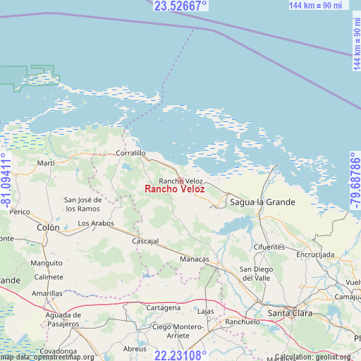
Rancho Veloz GPS coordinates[2]
22° 52' 49.512" North, 80° 23' 27.528" West
| Map corner | latitude | longitude |
|---|---|---|
| Upper-left | 23.52667°, | -81.09411° |
| Center: | 22.88042°, | -80.39098° |
| Lower-right: | 22.23108°, | -79.68786° |
| Map W x H: | 144.1×144.1 km | = 89.5×89.5mi |
| max Lat: | 23.15917° ⇑18.2% North |
| Rancho Veloz: | 22.88042° |
| min Lat: | ⇓81.8% South 19.90553° |
| min Long | Rancho Veloz | max Long |
| -84.28599° | -80.39098° | -74.15181° |
| W 42%⇐ | ⇒58% E |
Elevation
Elevation of Rancho Veloz is 59 m = 194 ft, and this is 9.6 m = 31 ft below average elevation for this country.
| Max E: |
761 m = 2497 ft | 44.2% |
| Avg. | 68.6 m = 225 ft | |
| Rancho Veloz | 59 m = 194 ft | |
Min E: |
3 m = 10 ft | 55.8% |
See also: Cuba elevation on elevation.city.
Geographical zone
Rancho Veloz is located in North Torrid zone (between Equator and Tropic of Cancer). Distance of this Northern Tropic circle is 61.9 km =38.5 mi to North.| Distance of | km | miles | from Rancho Veloz |
|---|---|---|---|
| North Pole | 7463 | 4637.3 | to North |
| Arctic Circle | 4857.1 | 3018.1 | to North |
| Tropic Cancer | 61.9 | 38.5 | to North |
| Equator | 2544.1 | 1580.8 | to South |


Nearby cities:
15 places around Rancho Veloz: (largest is in red/bold)
• Calabazar de Sagua
57.2 km =35.5 mi,  117°
117°
• Cifuentes
43.4 km =27 mi,  126°
126°
• Colón
55.6 km =34.5 mi,  251°
251°
• Corralillo
22.9 km =14.2 mi,  299°
299°
• Cruces
61.1 km =38 mi,  168°
168°
• Encrucijada
61.2 km =38 mi, 118°
• Esperanza
56.9 km =35.4 mi,  147°
147°
• Isabela de Sagua
39.4 km =24.5 mi,  80°
80°
• Lajas
52.7 km =32.7 mi, 169°
• Los Arabos
37.7 km =23.4 mi,  243°
243°
• Martí
54.6 km =33.9 mi,  277°
277°
• Quemado de Güines
17.5 km =10.9 mi, 125°
• Ranchuelo
61.6 km =38.3 mi,  156°
156°
• Sagua la Grande
33.3 km =20.7 mi,  104°
104°
• Santo Domingo
36 km =22.4 mi, 155°
Sources, notices
• [Note1] Compared only with cities in Cuba existing in our database
• [Src1] Map data: © OpenStreetMap contributors (CC-BY-SA)
• [Src2] Other city data from geonames.org with taken over terms of usage.
• [Src3] Geographical zone / Annual Mean Temperature by Robert A. Rohde @ Wikipedia
