Zscherben geodata
Zscherben (Saxony-Anhalt) is a section of populated place; located in Germany in Europe/Berlin (GMT+2) time zone. With population of 1,613 people, there are 5665 cities with bigger population in this country. Compared to other cities in Germany, 63.8% of cities are located further ↓South; 81.4% of cities are located further ←West and 69.7% of cities have higher elevation than Zscherben. Note1


Zscherben GPS coordinates[2]
51° 20' 8.736" North, 11° 58' 10.884" East
| Map corner | latitude | longitude |
|---|---|---|
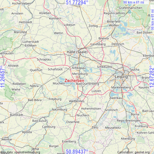
| Upper-left | 51.77294°, | 11.26657° |
| Center: | 51.33576°, | 11.96969° |
| Lower-right: | 50.89437°, | 12.67282° |
| Map W x H: | 97.7×97.7 km | = 60.7×60.7mi |
| max Lat: | 55.01917° ⇑36.2% North |
| Zscherben: | 51.33576° |
| min Lat: | ⇓63.8% South 47.40724° |
| min Long | Zscherben | max Long |
| 5.92978° | 11.96969° | 14.98853° |
| W 81.4%⇐ | ⇒18.6% E |
Elevation
Elevation of Zscherben is 93 m = 305 ft, and this is 156.1 m = 512 ft below average elevation for this country.
| Max E: |
1256 m = 4121 ft | 69.7% |
| Avg. | 249.1 m = 817 ft | |
| Zscherben | 93 m = 305 ft | |
Min E: |
-5 m = -16 ft | 30.3% |
See also: Germany elevation on elevation.city.
Geographical zone
Zscherben is located in North temperate zone (between Tropic of Cancer and the Arctic Circle). Distance of this North polar circle is 1693.2 km =1052.1 mi to North.| Distance of | km | miles | from Zscherben |
|---|---|---|---|
| North Pole | 4299.1 | 2671.3 | to North |
| Arctic Circle | 1693.2 | 1052.1 | to North |
| Tropic Cancer | 3102.1 | 1927.6 | to South |
| Equator | 5708 | 3546.8 | to South |


Nearby cities:
15 places around Zscherben: (largest is in red/bold)
• Bad Dürrenberg
8 km =5 mi,  123°
123°
• Beuna
2.5 km =1.6 mi,  212°
212°
• Braunsbedra
7.8 km =4.8 mi,  225°
225°
• Frankleben
3.9 km =2.4 mi, 226°
• Geusa
1.8 km =1.1 mi,  281°
281°
• Großkayna
5.6 km =3.5 mi, 207°
• Knapendorf
5 km =3.1 mi,  334°
334°
• Leuna
3.8 km =2.4 mi, 121°
• Merseburg
2.5 km =1.6 mi,  32°
32°
• Milzau
6.6 km =4.1 mi,  311°
311°
• Ostrau
6.7 km =4.2 mi, 116°
• Schkopau
6.4 km =4 mi,  349°
349°
• Spergau
6 km =3.7 mi,  141°
141°
• Wallendorf
7.8 km =4.8 mi,  69°
69°
• Wengelsdorf
7.9 km =4.9 mi, 140°
Sources, notices
• [Note1] Compared only with cities in Germany existing in our database
• [Src1] Map data: © OpenStreetMap contributors (CC-BY-SA)
• [Src2] Other city data from geonames.org with taken over terms of usage.
• [Src3] Geographical zone / Annual Mean Temperature by Robert A. Rohde @ Wikipedia
