Spergau geodata
Spergau (Saxony-Anhalt) is a populated place; located in Germany in Europe/Berlin (GMT+2) time zone. With population of 1,095 people, there are 6860 cities with bigger population in this country. Compared to other cities in Germany, 63.1% of cities are located further ↓South; 82.1% of cities are located further ←West and 68.3% of cities have higher elevation than Spergau. Note1


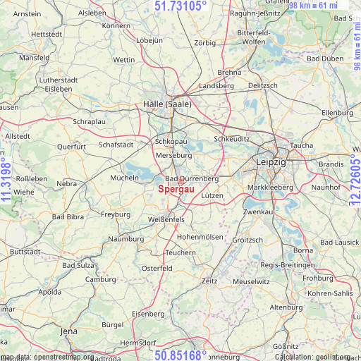
Spergau GPS coordinates[2]
51° 17' 36.492" North, 12° 1' 22.512" East
| Map corner | latitude | longitude |
|---|---|---|
| Upper-left | 51.73105°, | 11.3198° |
| Center: | 51.29347°, | 12.02292° |
| Lower-right: | 50.85168°, | 12.72605° |
| Map W x H: | 97.8×97.8 km | = 60.8×60.8mi |
| max Lat: | 55.01917° ⇑36.9% North |
| Spergau: | 51.29347° |
| min Lat: | ⇓63.1% South 47.40724° |
| min Long | Spergau | max Long |
| 5.92978° | 12.02292° | 14.98853° |
| W 82.1%⇐ | ⇒17.9% E |
Elevation
Elevation of Spergau is 101 m = 331 ft, and this is 148.1 m = 486 ft below average elevation for this country.
| Max E: |
1256 m = 4121 ft | 68.3% |
| Avg. | 249.1 m = 817 ft | |
| Spergau | 101 m = 331 ft | |
Min E: |
-5 m = -16 ft | 31.7% |
See also: Germany elevation on elevation.city.
Geographical zone
Spergau is located in North temperate zone (between Tropic of Cancer and the Arctic Circle). Distance of this North polar circle is 1697.9 km =1055 mi to North.| Distance of | km | miles | from Spergau |
|---|---|---|---|
| North Pole | 4303.8 | 2674.3 | to North |
| Arctic Circle | 1697.9 | 1055 | to North |
| Tropic Cancer | 3097.4 | 1924.6 | to South |
| Equator | 5703.3 | 3543.9 | to South |


Nearby cities:
15 places around Spergau: (largest is in red/bold)
• Bad Dürrenberg
3 km =1.9 mi,  85°
85°
• Beuna
5.7 km =3.5 mi,  296°
296°
• Dehlitz
7 km =4.3 mi,  180°
180°
• Frankleben
6.8 km =4.2 mi,  287°
287°
• Geusa
7.5 km =4.7 mi,  312°
312°
• Großkayna
6.3 km =3.9 mi,  267°
267°
• Großkorbetha
3.8 km =2.4 mi,  172°
172°
• Leuna
2.8 km =1.7 mi,  349°
349°
• Merseburg
7.2 km =4.5 mi,  341°
341°
• Ostrau
2.9 km =1.8 mi,  53°
53°
• Reichardtswerben
7 km =4.3 mi,  224°
224°
• Schkortleben
5.6 km =3.5 mi, 184°
• Tollwitz
5.2 km =3.2 mi,  99°
99°
• Wengelsdorf
1.9 km =1.2 mi,  135°
135°
• Zscherben
6 km =3.7 mi,  321°
321°
Sources, notices
• [Note1] Compared only with cities in Germany existing in our database
• [Src1] Map data: © OpenStreetMap contributors (CC-BY-SA)
• [Src2] Other city data from geonames.org with taken over terms of usage.
• [Src3] Geographical zone / Annual Mean Temperature by Robert A. Rohde @ Wikipedia
