Knapendorf geodata
Knapendorf (Saxony-Anhalt) is a populated place; located in Germany in Europe/Berlin (GMT+2) time zone. With population of 548 people, there are 9089 cities with bigger population in this country. Compared to other cities in Germany, 64.4% of cities are located further ↓South; 80.9% of cities are located further ←West and 69.5% of cities have higher elevation than Knapendorf. Note1


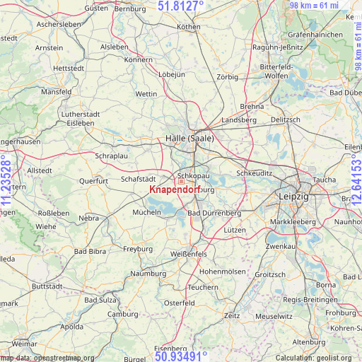
Knapendorf GPS coordinates[2]
51° 22' 33.276" North, 11° 56' 18.24" East
| Map corner | latitude | longitude |
|---|---|---|
| Upper-left | 51.8127°, | 11.23528° |
| Center: | 51.37591°, | 11.9384° |
| Lower-right: | 50.93491°, | 12.64153° |
| Map W x H: | 97.6×97.6 km | = 60.6×60.6mi |
| max Lat: | 55.01917° ⇑35.6% North |
| Knapendorf: | 51.37591° |
| min Lat: | ⇓64.4% South 47.40724° |
| min Long | Knapendorf | max Long |
| 5.92978° | 11.9384° | 14.98853° |
| W 80.9%⇐ | ⇒19.1% E |
Elevation
Elevation of Knapendorf is 94 m = 308 ft, and this is 155.1 m = 509 ft below average elevation for this country.
| Max E: |
1256 m = 4121 ft | 69.5% |
| Avg. | 249.1 m = 817 ft | |
| Knapendorf | 94 m = 308 ft | |
Min E: |
-5 m = -16 ft | 30.5% |
See also: Germany elevation on elevation.city.
Geographical zone
Knapendorf is located in North temperate zone (between Tropic of Cancer and the Arctic Circle). Distance of this North polar circle is 1688.7 km =1049.3 mi to North.| Distance of | km | miles | from Knapendorf |
|---|---|---|---|
| North Pole | 4294.6 | 2668.5 | to North |
| Arctic Circle | 1688.7 | 1049.3 | to North |
| Tropic Cancer | 3106.5 | 1930.3 | to South |
| Equator | 5712.5 | 3549.6 | to South |


Nearby cities:
15 places around Knapendorf: (largest is in red/bold)
• Bad Lauchstädt
4.9 km =3 mi,  283°
283°
• Beuna
6.6 km =4.1 mi,  173°
173°
• Delitz am Berge
5.3 km =3.3 mi,  329°
329°
• Döllnitz
7.2 km =4.5 mi,  60°
60°
• Frankleben
7.2 km =4.5 mi,  185°
185°
• Geusa
4.1 km =2.5 mi, 174°
• Hohenweiden
4.8 km =3 mi,  0°
0°
• Holleben
7.7 km =4.8 mi,  339°
339°
• Klobikau
7.8 km =4.8 mi,  248°
248°
• Leuna
8.4 km =5.2 mi,  140°
140°
• Lochau
8.3 km =5.2 mi,  73°
73°
• Merseburg
4.2 km =2.6 mi,  123°
123°
• Milzau
2.7 km =1.7 mi,  267°
267°
• Schkopau
2 km =1.2 mi,  28°
28°
• Zscherben
5 km =3.1 mi,  154°
154°
Sources, notices
• [Note1] Compared only with cities in Germany existing in our database
• [Src1] Map data: © OpenStreetMap contributors (CC-BY-SA)
• [Src2] Other city data from geonames.org with taken over terms of usage.
• [Src3] Geographical zone / Annual Mean Temperature by Robert A. Rohde @ Wikipedia
