Zapfendorf geodata
Zapfendorf (Bavaria) is a populated place; located in Germany in Europe/Berlin (GMT+2) time zone. With population of 5,017 people, there are 2823 cities with bigger population in this country. Compared to other cities in Germany, 63.1% of cities are located further ↑North; 66% of cities are located further ←West and 53.4% of cities have lower elevation than Zapfendorf. Note1
Administrative division(s):
- Level 1: Bavaria
- Level 2: Upper Franconia
- Level 3: Landkreis Bamberg
- Level 4: Zapfendorf, Markt


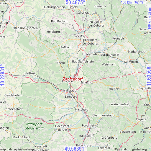
Zapfendorf GPS coordinates[2]
50° 1' 4.188" North, 10° 55' 56.748" East
| Map corner | latitude | longitude |
|---|---|---|
| Upper-left | 50.4675°, | 10.22931° |
| Center: | 50.01783°, | 10.93243° |
| Lower-right: | 49.56391°, | 11.63556° |
| Map W x H: | 100.5×100.5 km | = 62.4×62.4mi |
| max Lat: | 55.01917° ⇑63.1% North |
| Zapfendorf: | 50.01783° |
| min Lat: | ⇓36.9% South 47.40724° |
| min Long | Zapfendorf | max Long |
| 5.92978° | 10.93243° | 14.98853° |
| W 66%⇐ | ⇒34% E |
Elevation
Elevation of Zapfendorf is 249 m = 817 ft, and this is 0.099999999999994 m = 0 ft below average elevation for this country.
| Max E: |
1256 m = 4121 ft | 46.6% |
| Avg. | 249.1 m = 817 ft | |
| Zapfendorf | 249 m = 817 ft | |
Min E: |
-5 m = -16 ft | 53.4% |
See also: Germany elevation on elevation.city.
Geographical zone
Zapfendorf is located in North temperate zone (between Tropic of Cancer and the Arctic Circle). Distance of this North polar circle is 1839.7 km =1143.1 mi to North.| Distance of | km | miles | from Zapfendorf |
|---|---|---|---|
| North Pole | 4445.6 | 2762.4 | to North |
| Arctic Circle | 1839.7 | 1143.1 | to North |
| Tropic Cancer | 2955.5 | 1836.5 | to South |
| Equator | 5561.5 | 3455.8 | to South |


Nearby cities:
15 places around Zapfendorf: (largest is in red/bold)
• Bad Staffelstein
10.6 km =6.6 mi,  27°
27°
• Baunach
6.8 km =4.2 mi,  238°
238°
• Breitengüßbach
6.1 km =3.8 mi,  213°
213°
• Ebensfeld
5.7 km =3.5 mi,  18°
18°
• Gerach
9.6 km =6 mi,  280°
280°
• Gundelsheim
9 km =5.6 mi,  185°
185°
• Hallstadt
10.7 km =6.6 mi,  202°
202°
• Kemmern
8 km =5 mi, 209°
• Lauter
11.4 km =7.1 mi, 244°
• Memmelsdorf
9.9 km =6.2 mi,  168°
168°
• Oberhaid
12.7 km =7.9 mi,  221°
221°
• Rattelsdorf
3.1 km =1.9 mi,  264°
264°
• Reckendorf
7.1 km =4.4 mi,  268°
268°
• Rentweinsdorf
10.8 km =6.7 mi,  298°
298°
• Scheßlitz
8.6 km =5.3 mi,  123°
123°
Sources, notices
• [Note1] Compared only with cities in Germany existing in our database
• [Src1] Map data: © OpenStreetMap contributors (CC-BY-SA)
• [Src2] Other city data from geonames.org with taken over terms of usage.
• [Src3] Geographical zone / Annual Mean Temperature by Robert A. Rohde @ Wikipedia
