Wriezen geodata
Wriezen (Brandenburg) is a populated place; located in Germany in Europe/Berlin (GMT+2) time zone. With population of 8,213 people, there are 1924 cities with bigger population in this country. Compared to other cities in Germany, 79.8% of cities are located further ↓South; 98.4% of cities are located further ←West and 93.5% of cities have higher elevation than Wriezen. Note1
Administrative division(s):
- Level 1: Brandenburg
- Level 3: Landkreis Märkisch-Oderland
- Level 4: Wriezen


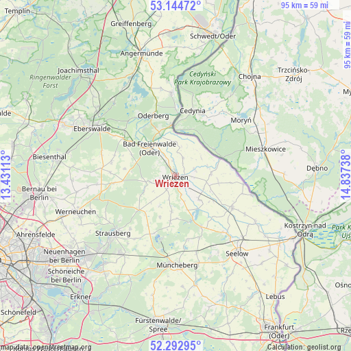
Wriezen GPS coordinates[2]
52° 43' 15.276" North, 14° 8' 3.3" East
| Map corner | latitude | longitude |
|---|---|---|
| Upper-left | 53.14472°, | 13.43113° |
| Center: | 52.72091°, | 14.13425° |
| Lower-right: | 52.29295°, | 14.83738° |
| Map W x H: | 94.7×94.7 km | = 58.8×58.8mi |
| max Lat: | 55.01917° ⇑20.2% North |
| Wriezen: | 52.72091° |
| min Lat: | ⇓79.8% South 47.40724° |
| min Long | Wriezen | max Long |
| 5.92978° | 14.13425° | 14.98853° |
| W 98.4%⇐ | ⇒1.6% E |
Elevation
Elevation of Wriezen is 12 m = 39 ft, and this is 237.1 m = 778 ft below average elevation for this country.
| Max E: |
1256 m = 4121 ft | 93.5% |
| Avg. | 249.1 m = 817 ft | |
| Wriezen | 12 m = 39 ft | |
Min E: |
-5 m = -16 ft | 6.5% |
See also: Germany elevation on elevation.city.
Geographical zone
Wriezen is located in North temperate zone (between Tropic of Cancer and the Arctic Circle). Distance of this North polar circle is 1539.2 km =956.4 mi to North.| Distance of | km | miles | from Wriezen |
|---|---|---|---|
| North Pole | 4145 | 2575.6 | to North |
| Arctic Circle | 1539.2 | 956.4 | to North |
| Tropic Cancer | 3256.1 | 2023.2 | to South |
| Equator | 5862 | 3642.5 | to South |


Nearby cities:
15 places around Wriezen: (largest is in red/bold)
• Bad Freienwalde
10.2 km =6.3 mi,  316°
316°
• Bliesdorf
3.5 km =2.2 mi,  151°
151°
• Buckow
17.7 km =11 mi,  193°
193°
• Falkenberg
15.1 km =9.4 mi,  308°
308°
• Hohenfinow
17.4 km =10.8 mi, 306°
• Hohensaaten
17.1 km =10.6 mi,  1°
1°
• Letschin
17.5 km =10.9 mi,  119°
119°
• Liepe
19.2 km =11.9 mi, 324°
• Neuhardenberg
15.5 km =9.6 mi, 153°
• Neulewin
9.8 km =6.1 mi,  87°
87°
• Neutrebbin
8.9 km =5.5 mi,  134°
134°
• Niederfinow
18.7 km =11.6 mi, 312°
• Oderberg
17.2 km =10.7 mi,  339°
339°
• Prötzel
13.6 km =8.5 mi,  226°
226°
• Waldsieversdorf
20.3 km =12.6 mi, 192°
Sources, notices
• [Note1] Compared only with cities in Germany existing in our database
• [Src1] Map data: © OpenStreetMap contributors (CC-BY-SA)
• [Src2] Other city data from geonames.org with taken over terms of usage.
• [Src3] Geographical zone / Annual Mean Temperature by Robert A. Rohde @ Wikipedia
