Waldsieversdorf geodata
Waldsieversdorf (Brandenburg) is a seat of a fourth-order administrative division; located in Germany in Europe/Berlin (GMT+2) time zone. With population of 1,314 people, there are 6268 cities with bigger population in this country. Compared to other cities in Germany, 77.9% of cities are located further ↓South; 98.2% of cities are located further ←West and 77% of cities have higher elevation than Waldsieversdorf. Note1
Administrative division(s):
- Level 1: Brandenburg
- Level 3: Landkreis Märkisch-Oderland
- Level 4: Waldsieversdorf


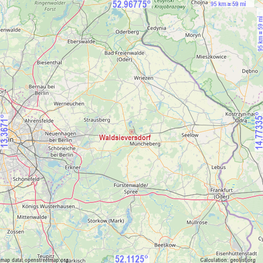
Waldsieversdorf GPS coordinates[2]
52° 32' 31.956" North, 14° 4' 12.792" East
| Map corner | latitude | longitude |
|---|---|---|
| Upper-left | 52.96775°, | 13.3671° |
| Center: | 52.54221°, | 14.07022° |
| Lower-right: | 52.1125°, | 14.77335° |
| Map W x H: | 95.1×95.1 km | = 59.1×59.1mi |
| max Lat: | 55.01917° ⇑22.1% North |
| Waldsieversdorf: | 52.54221° |
| min Lat: | ⇓77.9% South 47.40724° |
| min Long | Waldsieversdorf | max Long |
| 5.92978° | 14.07022° | 14.98853° |
| W 98.2%⇐ | ⇒1.8% E |
Elevation
Elevation of Waldsieversdorf is 56 m = 184 ft, and this is 193.1 m = 634 ft below average elevation for this country.
| Max E: |
1256 m = 4121 ft | 77% |
| Avg. | 249.1 m = 817 ft | |
| Waldsieversdorf | 56 m = 184 ft | |
Min E: |
-5 m = -16 ft | 23% |
See also: Germany elevation on elevation.city.
Geographical zone
Waldsieversdorf is located in North temperate zone (between Tropic of Cancer and the Arctic Circle). Distance of this North polar circle is 1559 km =968.7 mi to North.| Distance of | km | miles | from Waldsieversdorf |
|---|---|---|---|
| North Pole | 4164.9 | 2587.9 | to North |
| Arctic Circle | 1559 | 968.7 | to North |
| Tropic Cancer | 3236.2 | 2010.9 | to South |
| Equator | 5842.1 | 3630.1 | to South |


Nearby cities:
15 places around Waldsieversdorf: (largest is in red/bold)
• Bliesdorf
17.8 km =11.1 mi,  19°
19°
• Buckow
2.7 km =1.7 mi,  5°
5°
• Falkenhagen
20.6 km =12.8 mi,  125°
125°
• Fürstenwalde
20.2 km =12.6 mi,  181°
181°
• Lietzen
20 km =12.4 mi,  113°
113°
• Müncheberg
6 km =3.7 mi, 130°
• Neuhardenberg
12.8 km =8 mi,  62°
62°
• Neutrebbin
17.3 km =10.7 mi,  38°
38°
• Petershagen
19.3 km =12 mi,  262°
262°
• Prötzel
11.9 km =7.4 mi,  332°
332°
• Rehfelde
11 km =6.8 mi,  265°
265°
• Seelow
21.1 km =13.1 mi,  92°
92°
• Steinhöfel
17.1 km =10.6 mi,  157°
157°
• Strausberg
13 km =8.1 mi,  288°
288°
• Wriezen
20.3 km =12.6 mi, 12°
Sources, notices
• [Note1] Compared only with cities in Germany existing in our database
• [Src1] Map data: © OpenStreetMap contributors (CC-BY-SA)
• [Src2] Other city data from geonames.org with taken over terms of usage.
• [Src3] Geographical zone / Annual Mean Temperature by Robert A. Rohde @ Wikipedia
