Wolkramshausen geodata
Wolkramshausen (Thuringia) is a seat of a fourth-order administrative division; located in Germany in Europe/Berlin (GMT+2) time zone. With population of 1,180 people, there are 6618 cities with bigger population in this country. Compared to other cities in Germany, 65.1% of cities are located further ↓South; 63.1% of cities are located further ←West and 52.4% of cities have higher elevation than Wolkramshausen. Note1
Administrative division(s):
- Level 1: Thuringia
- Level 3: Landkreis Nordhausen
- Level 4: Stadt Bleicherode


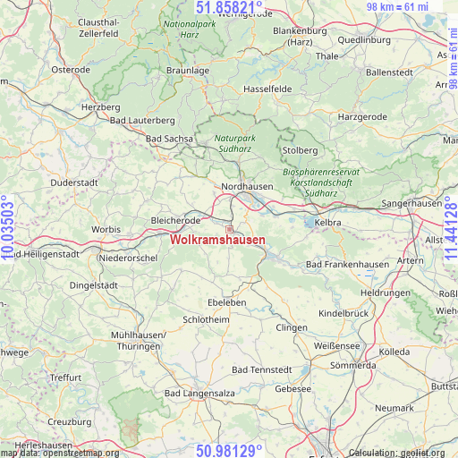
Wolkramshausen GPS coordinates[2]
51° 25' 18.66" North, 10° 44' 17.34" East
| Map corner | latitude | longitude |
|---|---|---|
| Upper-left | 51.85821°, | 10.03503° |
| Center: | 51.42185°, | 10.73815° |
| Lower-right: | 50.98129°, | 11.44128° |
| Map W x H: | 97.5×97.5 km | = 60.6×60.6mi |
| max Lat: | 55.01917° ⇑34.9% North |
| Wolkramshausen: | 51.42185° |
| min Lat: | ⇓65.1% South 47.40724° |
| min Long | Wolkramshausen | max Long |
| 5.92978° | 10.73815° | 14.98853° |
| W 63.1%⇐ | ⇒36.9% E |
Elevation
Elevation of Wolkramshausen is 208 m = 682 ft, and this is 41.1 m = 135 ft below average elevation for this country.
| Max E: |
1256 m = 4121 ft | 52.4% |
| Avg. | 249.1 m = 817 ft | |
| Wolkramshausen | 208 m = 682 ft | |
Min E: |
-5 m = -16 ft | 47.6% |
See also: Germany elevation on elevation.city.
Geographical zone
Wolkramshausen is located in North temperate zone (between Tropic of Cancer and the Arctic Circle). Distance of this North polar circle is 1683.6 km =1046.1 mi to North.| Distance of | km | miles | from Wolkramshausen |
|---|---|---|---|
| North Pole | 4289.5 | 2665.4 | to North |
| Arctic Circle | 1683.6 | 1046.1 | to North |
| Tropic Cancer | 3111.7 | 1933.5 | to South |
| Equator | 5717.6 | 3552.8 | to South |


Nearby cities:
15 places around Wolkramshausen: (largest is in red/bold)
• Bleicherode
11.7 km =7.3 mi,  280°
280°
• Etzelsrode
12.1 km =7.5 mi,  315°
315°
• Heringen
10 km =6.2 mi,  73°
73°
• Kehmstedt
10.5 km =6.5 mi,  302°
302°
• Kleinfurra
2 km =1.2 mi,  110°
110°
• Kleinwenden
5.5 km =3.4 mi,  263°
263°
• Niedergebra
9.6 km =6 mi,  270°
270°
• Nohra
2.9 km =1.8 mi, 295°
• Nordhausen
9.7 km =6 mi,  24°
24°
• Obergebra
11 km =6.8 mi, 265°
• Schernberg
10.7 km =6.6 mi,  168°
168°
• Sondershausen
10.8 km =6.7 mi,  122°
122°
• Uthleben
7.6 km =4.7 mi, 66°
• Windehausen
10.5 km =6.5 mi,  62°
62°
• Wipperdorf
7.5 km =4.7 mi, 299°
Sources, notices
• [Note1] Compared only with cities in Germany existing in our database
• [Src1] Map data: © OpenStreetMap contributors (CC-BY-SA)
• [Src2] Other city data from geonames.org with taken over terms of usage.
• [Src3] Geographical zone / Annual Mean Temperature by Robert A. Rohde @ Wikipedia
