Schernberg geodata
Schernberg (Thuringia) is a populated place; located in Germany in Europe/Berlin (GMT+2) time zone. With population of 3,427 people, there are 3670 cities with bigger population in this country. Compared to other cities in Germany, 63.6% of cities are located further ↓South; 63.6% of cities are located further ←West and 66.8% of cities have lower elevation than Schernberg. Note1


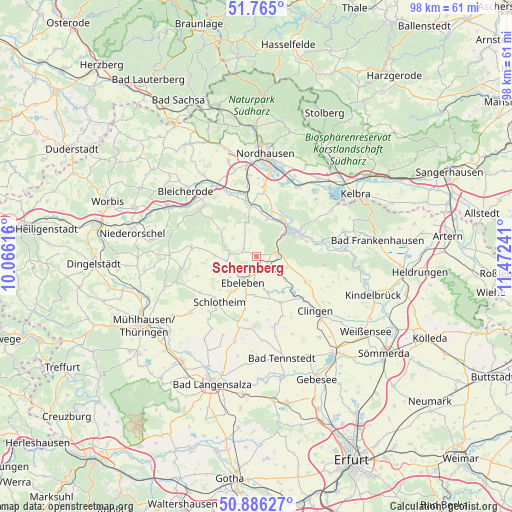
Schernberg GPS coordinates[2]
51° 19' 39.864" North, 10° 46' 9.408" East
| Map corner | latitude | longitude |
|---|---|---|
| Upper-left | 51.765°, | 10.06616° |
| Center: | 51.32774°, | 10.76928° |
| Lower-right: | 50.88627°, | 11.47241° |
| Map W x H: | 97.7×97.7 km | = 60.7×60.7mi |
| max Lat: | 55.01917° ⇑36.4% North |
| Schernberg: | 51.32774° |
| min Lat: | ⇓63.6% South 47.40724° |
| min Long | Schernberg | max Long |
| 5.92978° | 10.76928° | 14.98853° |
| W 63.6%⇐ | ⇒36.4% E |
Elevation
Elevation of Schernberg is 334 m = 1096 ft, and this is 84.9 m = 279 ft above average elevation for this country.
| Max E: |
1256 m = 4121 ft | 33.2% |
| Schernberg | 334 m 1096 ft | |
| Avg. | 249.1 m = 817 ft | |
Min E: |
-5 m = -16 ft | 66.8% |
See also: Germany elevation on elevation.city.
Geographical zone
Schernberg is located in North temperate zone (between Tropic of Cancer and the Arctic Circle). Distance of this North polar circle is 1694.1 km =1052.7 mi to North.| Distance of | km | miles | from Schernberg |
|---|---|---|---|
| North Pole | 4300 | 2671.9 | to North |
| Arctic Circle | 1694.1 | 1052.7 | to North |
| Tropic Cancer | 3101.2 | 1927 | to South |
| Equator | 5707.1 | 3546.2 | to South |


Nearby cities:
15 places around Schernberg: (largest is in red/bold)
• Abtsbessingen
7.4 km =4.6 mi,  183°
183°
• Bellstedt
6.9 km =4.3 mi,  171°
171°
• Ebeleben
5.7 km =3.5 mi,  208°
208°
• Freienbessingen
10.5 km =6.5 mi, 180°
• Großenehrich
9.9 km =6.2 mi,  152°
152°
• Holzsußra
7.8 km =4.8 mi,  230°
230°
• Kleinfurra
9.8 km =6.1 mi,  358°
358°
• Rockstedt
4.8 km =3 mi,  186°
186°
• Schlotheim
11.9 km =7.4 mi,  220°
220°
• Sondershausen
8.4 km =5.2 mi,  56°
56°
• Thüringenhausen
7.1 km =4.4 mi,  162°
162°
• Urbach
12 km =7.5 mi,  252°
252°
• Wasserthaleben
11.7 km =7.3 mi,  137°
137°
• Wolferschwenda
10.7 km =6.6 mi, 168°
• Wolkramshausen
10.7 km =6.6 mi,  348°
348°
Sources, notices
• [Note1] Compared only with cities in Germany existing in our database
• [Src1] Map data: © OpenStreetMap contributors (CC-BY-SA)
• [Src2] Other city data from geonames.org with taken over terms of usage.
• [Src3] Geographical zone / Annual Mean Temperature by Robert A. Rohde @ Wikipedia
