Winhöring geodata
Winhöring (Bavaria) is a seat of a fourth-order administrative division; located in Germany in Europe/Berlin (GMT+2) time zone. With population of 4,917 people, there are 2854 cities with bigger population in this country. Compared to other cities in Germany, 91.7% of cities are located further ↑North; 89.3% of cities are located further ←West and 73.3% of cities have lower elevation than Winhöring. Note1
Administrative division(s):
- Level 1: Bavaria
- Level 2: Upper Bavaria
- Level 3: Landkreis Altötting
- Level 4: Winhöring


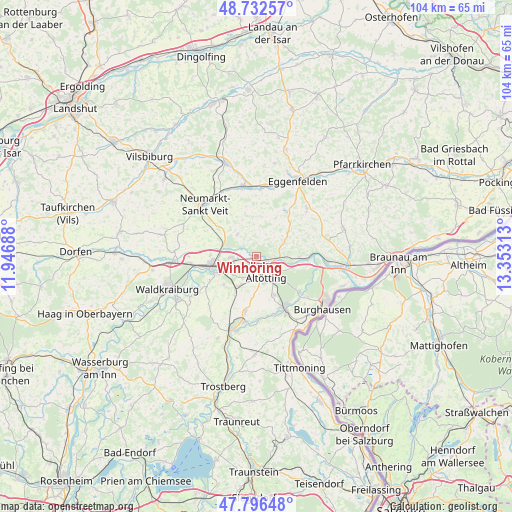
Winhöring GPS coordinates[2]
48° 16' 0.012" North, 12° 39' 0" East
| Map corner | latitude | longitude |
|---|---|---|
| Upper-left | 48.73257°, | 11.94688° |
| Center: | 48.26667°, | 12.65° |
| Lower-right: | 47.79648°, | 13.35313° |
| Map W x H: | 104.1×104.1 km | = 64.7×64.7mi |
| max Lat: | 55.01917° ⇑91.7% North |
| Winhöring: | 48.26667° |
| min Lat: | ⇓8.3% South 47.40724° |
| min Long | Winhöring | max Long |
| 5.92978° | 12.65° | 14.98853° |
| W 89.3%⇐ | ⇒10.7% E |
Elevation
Elevation of Winhöring is 385 m = 1263 ft, and this is 135.9 m = 446 ft above average elevation for this country.
| Max E: |
1256 m = 4121 ft | 26.7% |
| Winhöring | 385 m 1263 ft | |
| Avg. | 249.1 m = 817 ft | |
Min E: |
-5 m = -16 ft | 73.3% |
See also: Germany elevation on elevation.city.
Geographical zone
Winhöring is located in North temperate zone (between Tropic of Cancer and the Arctic Circle). Distance of this North polar circle is 2034.4 km =1264.1 mi to North.| Distance of | km | miles | from Winhöring |
|---|---|---|---|
| North Pole | 4640.3 | 2883.3 | to North |
| Arctic Circle | 2034.4 | 1264.1 | to North |
| Tropic Cancer | 2760.8 | 1715.5 | to South |
| Equator | 5366.8 | 3334.8 | to South |


Nearby cities:
15 places around Winhöring: (largest is in red/bold)
• Altötting
5 km =3.1 mi,  156°
156°
• Aresing
3.5 km =2.2 mi,  289°
289°
• Erharting
5.3 km =3.3 mi, 290°
• Geratskirchen
8 km =5 mi,  6°
6°
• Kastl
8.3 km =5.2 mi,  153°
153°
• Mühldorf
9.8 km =6.1 mi,  256°
256°
• Neuötting
4.1 km =2.5 mi,  133°
133°
• Perach
8.6 km =5.3 mi,  90°
90°
• Pleiskirchen
5.9 km =3.7 mi,  319°
319°
• Polling
8.3 km =5.2 mi,  227°
227°
• Reischach
6.2 km =3.9 mi,  64°
64°
• Rohrbach
7.4 km =4.6 mi, 289°
• Teising
5.2 km =3.2 mi,  213°
213°
• Töging am Inn
4.9 km =3 mi, 261°
• Tüßling
7.1 km =4.4 mi, 211°
Sources, notices
• [Note1] Compared only with cities in Germany existing in our database
• [Src1] Map data: © OpenStreetMap contributors (CC-BY-SA)
• [Src2] Other city data from geonames.org with taken over terms of usage.
• [Src3] Geographical zone / Annual Mean Temperature by Robert A. Rohde @ Wikipedia
