Werder geodata
Werder (Brandenburg) is a populated place; located in Germany in Europe/Berlin (GMT+2) time zone. With population of 22,384 people, there are 670 cities with bigger population in this country. Compared to other cities in Germany, 75.9% of cities are located further ↓South; 91.8% of cities are located further ←West and 85.8% of cities have higher elevation than Werder. Note1
Administrative division(s):
- Level 1: Brandenburg
- Level 3: Landkreis Potsdam-Mittelmark
- Level 4: Werder (Havel)


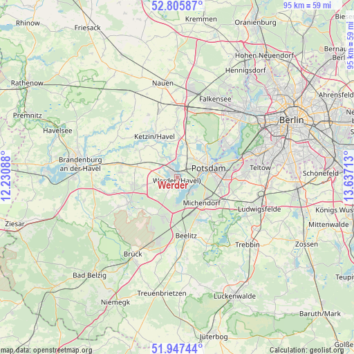
Werder GPS coordinates[2]
52° 22' 43.464" North, 12° 56' 2.4" East
| Map corner | latitude | longitude |
|---|---|---|
| Upper-left | 52.80587°, | 12.23088° |
| Center: | 52.37874°, | 12.934° |
| Lower-right: | 51.94744°, | 13.63713° |
| Map W x H: | 95.4×95.4 km | = 59.3×59.3mi |
| max Lat: | 55.01917° ⇑24.1% North |
| Werder: | 52.37874° |
| min Lat: | ⇓75.9% South 47.40724° |
| min Long | Werder | max Long |
| 5.92978° | 12.934° | 14.98853° |
| W 91.8%⇐ | ⇒8.2% E |
Elevation
Elevation of Werder is 33 m = 108 ft, and this is 216.1 m = 709 ft below average elevation for this country.
| Max E: |
1256 m = 4121 ft | 85.8% |
| Avg. | 249.1 m = 817 ft | |
| Werder | 33 m = 108 ft | |
Min E: |
-5 m = -16 ft | 14.2% |
See also: Germany elevation on elevation.city.
Geographical zone
Werder is located in North temperate zone (between Tropic of Cancer and the Arctic Circle). Distance of this North polar circle is 1577.2 km =980 mi to North.| Distance of | km | miles | from Werder |
|---|---|---|---|
| North Pole | 4183.1 | 2599.3 | to North |
| Arctic Circle | 1577.2 | 980 | to North |
| Tropic Cancer | 3218.1 | 1999.6 | to South |
| Equator | 5824 | 3618.9 | to South |


Nearby cities:
15 places around Werder: (largest is in red/bold)
• Beelitz
15.8 km =9.8 mi,  170°
170°
• Borkheide
18.9 km =11.7 mi,  197°
197°
• Borkwalde
15.9 km =9.9 mi,  205°
205°
• Fichtenwalde
11.5 km =7.1 mi, 197°
• Groß Kreutz
10.8 km =6.7 mi,  284°
284°
• Ketzin
12.6 km =7.8 mi,  331°
331°
• Kladow
16.6 km =10.3 mi,  59°
59°
• Kloster Lehnin
14.5 km =9 mi,  243°
243°
• Michendorf
9.8 km =6.1 mi,  138°
138°
• Nikolassee
19.1 km =11.9 mi,  71°
71°
• Potsdam
9.2 km =5.7 mi,  75°
75°
• Roskow
17.9 km =11.1 mi,  305°
305°
• Stahnsdorf
19.2 km =11.9 mi,  88°
88°
• Wannsee
15.7 km =9.8 mi, 73°
• Wustermark
19.1 km =11.9 mi,  3°
3°
Sources, notices
• [Note1] Compared only with cities in Germany existing in our database
• [Src1] Map data: © OpenStreetMap contributors (CC-BY-SA)
• [Src2] Other city data from geonames.org with taken over terms of usage.
• [Src3] Geographical zone / Annual Mean Temperature by Robert A. Rohde @ Wikipedia
