Roskow geodata
Roskow (Brandenburg) is a seat of a fourth-order administrative division; located in Germany in Europe/Berlin (GMT+2) time zone. With population of 1,281 people, there are 6363 cities with bigger population in this country. Compared to other cities in Germany, 77.1% of cities are located further ↓South; 90% of cities are located further ←West and 85.8% of cities have higher elevation than Roskow. Note1
Administrative division(s):
- Level 1: Brandenburg
- Level 3: Landkreis Potsdam-Mittelmark
- Level 4: Roskow


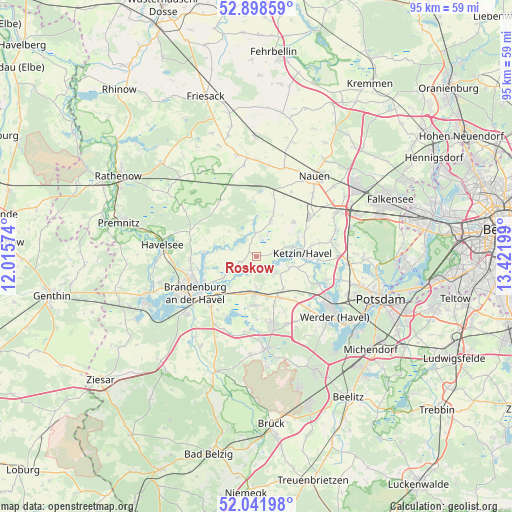
Roskow GPS coordinates[2]
52° 28' 20.532" North, 12° 43' 7.896" East
| Map corner | latitude | longitude |
|---|---|---|
| Upper-left | 52.89859°, | 12.01574° |
| Center: | 52.47237°, | 12.71886° |
| Lower-right: | 52.04198°, | 13.42199° |
| Map W x H: | 95.2×95.2 km | = 59.2×59.2mi |
| max Lat: | 55.01917° ⇑22.9% North |
| Roskow: | 52.47237° |
| min Lat: | ⇓77.1% South 47.40724° |
| min Long | Roskow | max Long |
| 5.92978° | 12.71886° | 14.98853° |
| W 90%⇐ | ⇒10% E |
Elevation
Elevation of Roskow is 33 m = 108 ft, and this is 216.1 m = 709 ft below average elevation for this country.
| Max E: |
1256 m = 4121 ft | 85.8% |
| Avg. | 249.1 m = 817 ft | |
| Roskow | 33 m = 108 ft | |
Min E: |
-5 m = -16 ft | 14.2% |
See also: Germany elevation on elevation.city.
Geographical zone
Roskow is located in North temperate zone (between Tropic of Cancer and the Arctic Circle). Distance of this North polar circle is 1566.8 km =973.6 mi to North.| Distance of | km | miles | from Roskow |
|---|---|---|---|
| North Pole | 4172.7 | 2592.8 | to North |
| Arctic Circle | 1566.8 | 973.6 | to North |
| Tropic Cancer | 3228.5 | 2006.1 | to South |
| Equator | 5834.4 | 3625.3 | to South |


Nearby cities:
15 places around Roskow: (largest is in red/bold)
• Brandenburg an der Havel
13 km =8.1 mi,  241°
241°
• Brieselang
22.7 km =14.1 mi,  57°
57°
• Golzow
23.2 km =14.4 mi,  200°
200°
• Groß Kreutz
8.8 km =5.5 mi,  152°
152°
• Ketzin
8.6 km =5.3 mi,  85°
85°
• Kloster Lehnin
17 km =10.6 mi,  174°
174°
• Kotzen
22.5 km =14 mi,  322°
322°
• Nauen
18.3 km =11.4 mi,  34°
34°
• Nennhausen
20.5 km =12.7 mi,  313°
313°
• Paulinenaue
22.8 km =14.2 mi,  358°
358°
• Pessin
19.2 km =11.9 mi,  349°
349°
• Päwesin
4.9 km =3 mi, 358°
• Retzow
17.1 km =10.6 mi, 352°
• Werder
17.9 km =11.1 mi,  125°
125°
• Wustermark
17.9 km =11.1 mi, 61°
Sources, notices
• [Note1] Compared only with cities in Germany existing in our database
• [Src1] Map data: © OpenStreetMap contributors (CC-BY-SA)
• [Src2] Other city data from geonames.org with taken over terms of usage.
• [Src3] Geographical zone / Annual Mean Temperature by Robert A. Rohde @ Wikipedia
