Weiten-Gesäß geodata
Weiten-Gesäß (Hesse) is a populated place; located in Germany in Europe/Berlin (GMT+2) time zone. With population of 961 people, there are 7309 cities with bigger population in this country. Compared to other cities in Germany, 71.4% of cities are located further ↑North; 64.8% of cities are located further →East and 64.3% of cities have lower elevation than Weiten-Gesäß. Note1
Administrative division(s):
- Level 1: Hesse
- Level 2: Regierungsbezirk Darmstadt
- Level 3: Odenwaldkreis
- Level 4: Michelstadt


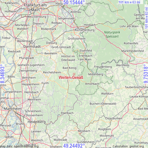
Weiten-Gesäß GPS coordinates[2]
49° 42' 6.516" North, 9° 3' 0.216" East
| Map corner | latitude | longitude |
|---|---|---|
| Upper-left | 50.15444°, | 8.34693° |
| Center: | 49.70181°, | 9.05006° |
| Lower-right: | 49.24492°, | 9.75318° |
| Map W x H: | 101.1×101.1 km | = 62.8×62.8mi |
| max Lat: | 55.01917° ⇑71.4% North |
| Weiten-Gesäß: | 49.70181° |
| min Lat: | ⇓28.6% South 47.40724° |
| min Long | Weiten-Gesäß | max Long |
| 5.92978° | 9.05006° | 14.98853° |
| W 35.2%⇐ | ⇒64.8% E |
Elevation
Elevation of Weiten-Gesäß is 317 m = 1040 ft, and this is 67.9 m = 223 ft above average elevation for this country.
| Max E: |
1256 m = 4121 ft | 35.7% |
| Weiten-Gesäß | 317 m 1040 ft | |
| Avg. | 249.1 m = 817 ft | |
Min E: |
-5 m = -16 ft | 64.3% |
See also: Germany elevation on elevation.city.
Geographical zone
Weiten-Gesäß is located in North temperate zone (between Tropic of Cancer and the Arctic Circle). Distance of this North polar circle is 1874.9 km =1165 mi to North.| Distance of | km | miles | from Weiten-Gesäß |
|---|---|---|---|
| North Pole | 4480.7 | 2784.2 | to North |
| Arctic Circle | 1874.9 | 1165 | to North |
| Tropic Cancer | 2920.4 | 1814.7 | to South |
| Equator | 5526.3 | 3433.9 | to South |


Nearby cities:
15 places around Weiten-Gesäß: (largest is in red/bold)
• Bad König
5.5 km =3.4 mi,  326°
326°
• Brensbach
14.3 km =8.9 mi,  303°
303°
• Erbach
6 km =3.7 mi,  221°
221°
• Erlenbach am Main
13.9 km =8.6 mi,  35°
35°
• Großheubach
12.8 km =8 mi,  76°
76°
• Höchst im Odenwald
11.5 km =7.1 mi,  341°
341°
• Kirchzell
13.1 km =8.1 mi,  135°
135°
• Kleinheubach
11.9 km =7.4 mi, 79°
• Klingenberg am Main
13.2 km =8.2 mi,  45°
45°
• Laudenbach
10.3 km =6.4 mi,  61°
61°
• Lützelbach
9.8 km =6.1 mi,  10°
10°
• Michelstadt
4.4 km =2.7 mi,  228°
228°
• Rüdenau
9.3 km =5.8 mi, 83°
• Weilbach
12.5 km =7.8 mi,  107°
107°
• Wörth am Main
13 km =8.1 mi, 35°
Sources, notices
• [Note1] Compared only with cities in Germany existing in our database
• [Src1] Map data: © OpenStreetMap contributors (CC-BY-SA)
• [Src2] Other city data from geonames.org with taken over terms of usage.
• [Src3] Geographical zone / Annual Mean Temperature by Robert A. Rohde @ Wikipedia
