Weiten geodata
Weiten (Saarland) is a populated place; located in Germany in Europe/Berlin (GMT+2) time zone. With population of 1,209 people, there are 6538 cities with bigger population in this country. Compared to other cities in Germany, 75.2% of cities are located further ↑North; 97.5% of cities are located further →East and 73.3% of cities have lower elevation than Weiten. Note1


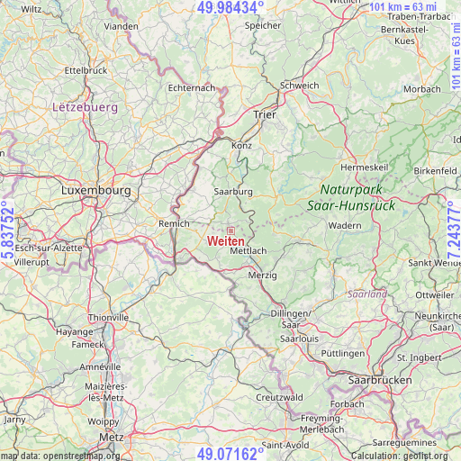
Weiten GPS coordinates[2]
49° 31' 48.396" North, 6° 32' 26.304" East
| Map corner | latitude | longitude |
|---|---|---|
| Upper-left | 49.98434°, | 5.83752° |
| Center: | 49.53011°, | 6.54064° |
| Lower-right: | 49.07162°, | 7.24377° |
| Map W x H: | 101.5×101.5 km | = 63.1×63.1mi |
| max Lat: | 55.01917° ⇑75.2% North |
| Weiten: | 49.53011° |
| min Lat: | ⇓24.8% South 47.40724° |
| min Long | Weiten | max Long |
| 5.92978° | 6.54064° | 14.98853° |
| W 2.5%⇐ | ⇒97.5% E |
Elevation
Elevation of Weiten is 385 m = 1263 ft, and this is 135.9 m = 446 ft above average elevation for this country.
| Max E: |
1256 m = 4121 ft | 26.7% |
| Weiten | 385 m 1263 ft | |
| Avg. | 249.1 m = 817 ft | |
Min E: |
-5 m = -16 ft | 73.3% |
See also: Germany elevation on elevation.city.
Geographical zone
Weiten is located in North temperate zone (between Tropic of Cancer and the Arctic Circle). Distance of this North polar circle is 1893.9 km =1176.8 mi to North.| Distance of | km | miles | from Weiten |
|---|---|---|---|
| North Pole | 4499.8 | 2796 | to North |
| Arctic Circle | 1893.9 | 1176.8 | to North |
| Tropic Cancer | 2901.3 | 1802.8 | to South |
| Equator | 5507.2 | 3422 | to South |


Nearby cities:
15 places around Weiten: (largest is in red/bold)
• Britten
9.9 km =6.2 mi,  96°
96°
• Fisch
10.5 km =6.5 mi,  336°
336°
• Freudenburg
1.6 km =1 mi, 339°
• Irsch
9.2 km =5.7 mi,  25°
25°
• Kastel-Staadt
4.1 km =2.5 mi,  19°
19°
• Kirf
4.7 km =2.9 mi,  298°
298°
• Merzkirchen
7.2 km =4.5 mi,  325°
325°
• Mettlach
5.1 km =3.2 mi,  140°
140°
• Ockfen
10.1 km =6.3 mi, 17°
• Orscholz
2.9 km =1.8 mi,  202°
202°
• Saarburg
8.5 km =5.3 mi,  1°
1°
• Saarhölzbach
5.1 km =3.2 mi,  108°
108°
• Serrig
5.6 km =3.5 mi, 26°
• Taben-Rodt
3.8 km =2.4 mi,  54°
54°
• Trassem
5.5 km =3.4 mi,  348°
348°
Sources, notices
• [Note1] Compared only with cities in Germany existing in our database
• [Src1] Map data: © OpenStreetMap contributors (CC-BY-SA)
• [Src2] Other city data from geonames.org with taken over terms of usage.
• [Src3] Geographical zone / Annual Mean Temperature by Robert A. Rohde @ Wikipedia
