Mettlach geodata
Mettlach (Saarland) is a seat of a fourth-order administrative division; located in Germany in Europe/Berlin (GMT+2) time zone. With population of 3,279 people, there are 3770 cities with bigger population in this country. Compared to other cities in Germany, 75.8% of cities are located further ↑North; 97.1% of cities are located further →East and 58.9% of cities have higher elevation than Mettlach. Note1


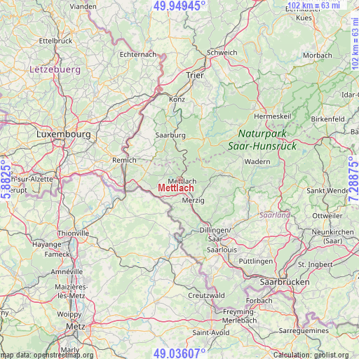
Mettlach GPS coordinates[2]
49° 29' 41.604" North, 6° 35' 8.232" East
| Map corner | latitude | longitude |
|---|---|---|
| Upper-left | 49.94945°, | 5.8825° |
| Center: | 49.49489°, | 6.58562° |
| Lower-right: | 49.03607°, | 7.28875° |
| Map W x H: | 101.6×101.6 km | = 63.1×63.1mi |
| max Lat: | 55.01917° ⇑75.8% North |
| Mettlach: | 49.49489° |
| min Lat: | ⇓24.2% South 47.40724° |
| min Long | Mettlach | max Long |
| 5.92978° | 6.58562° | 14.98853° |
| W 2.9%⇐ | ⇒97.1% E |
Elevation
Elevation of Mettlach is 161 m = 528 ft, and this is 88.1 m = 289 ft below average elevation for this country.
| Max E: |
1256 m = 4121 ft | 58.9% |
| Avg. | 249.1 m = 817 ft | |
| Mettlach | 161 m = 528 ft | |
Min E: |
-5 m = -16 ft | 41.1% |
See also: Germany elevation on elevation.city.
Geographical zone
Mettlach is located in North temperate zone (between Tropic of Cancer and the Arctic Circle). Distance of this North polar circle is 1897.9 km =1179.3 mi to North.| Distance of | km | miles | from Mettlach |
|---|---|---|---|
| North Pole | 4503.7 | 2798.5 | to North |
| Arctic Circle | 1897.9 | 1179.3 | to North |
| Tropic Cancer | 2897.4 | 1800.4 | to South |
| Equator | 5503.3 | 3419.6 | to South |


Nearby cities:
15 places around Mettlach: (largest is in red/bold)
• Britten
7.2 km =4.5 mi,  66°
66°
• Freudenburg
6.6 km =4.1 mi,  324°
324°
• Greimerath
10.3 km =6.4 mi,  43°
43°
• Irsch
12.2 km =7.6 mi,  3°
3°
• Kastel-Staadt
8 km =5 mi,  346°
346°
• Kirf
9.6 km =6 mi,  309°
309°
• Losheim
11.7 km =7.3 mi,  81°
81°
• Merzig
6.9 km =4.3 mi,  146°
146°
• Merzkirchen
12.3 km =7.6 mi, 323°
• Orscholz
4.5 km =2.8 mi,  285°
285°
• Saarhölzbach
2.8 km =1.7 mi,  34°
34°
• Serrig
9 km =5.6 mi, 354°
• Taben-Rodt
6.1 km =3.8 mi,  358°
358°
• Trassem
10.3 km =6.4 mi,  334°
334°
• Weiten
5.1 km =3.2 mi, 320°
Sources, notices
• [Note1] Compared only with cities in Germany existing in our database
• [Src1] Map data: © OpenStreetMap contributors (CC-BY-SA)
• [Src2] Other city data from geonames.org with taken over terms of usage.
• [Src3] Geographical zone / Annual Mean Temperature by Robert A. Rohde @ Wikipedia
