Orscholz geodata
Orscholz (Saarland) is a populated place; located in Germany in Europe/Berlin (GMT+2) time zone. With population of 3,609 people, there are 3533 cities with bigger population in this country. Compared to other cities in Germany, 75.6% of cities are located further ↑North; 97.6% of cities are located further →East and 77% of cities have lower elevation than Orscholz. Note1


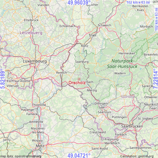
Orscholz GPS coordinates[2]
49° 30' 21.348" North, 6° 31' 30.072" East
| Map corner | latitude | longitude |
|---|---|---|
| Upper-left | 49.96039°, | 5.82189° |
| Center: | 49.50593°, | 6.52502° |
| Lower-right: | 49.04721°, | 7.22814° |
| Map W x H: | 101.5×101.5 km | = 63.1×63.1mi |
| max Lat: | 55.01917° ⇑75.6% North |
| Orscholz: | 49.50593° |
| min Lat: | ⇓24.4% South 47.40724° |
| min Long | Orscholz | max Long |
| 5.92978° | 6.52502° | 14.98853° |
| W 2.4%⇐ | ⇒97.6% E |
Elevation
Elevation of Orscholz is 412 m = 1352 ft, and this is 162.9 m = 534 ft above average elevation for this country.
| Max E: |
1256 m = 4121 ft | 23% |
| Orscholz | 412 m 1352 ft | |
| Avg. | 249.1 m = 817 ft | |
Min E: |
-5 m = -16 ft | 77% |
See also: Germany elevation on elevation.city.
Geographical zone
Orscholz is located in North temperate zone (between Tropic of Cancer and the Arctic Circle). Distance of this North polar circle is 1896.6 km =1178.5 mi to North.| Distance of | km | miles | from Orscholz |
|---|---|---|---|
| North Pole | 4502.5 | 2797.7 | to North |
| Arctic Circle | 1896.6 | 1178.5 | to North |
| Tropic Cancer | 2898.6 | 1801.1 | to South |
| Equator | 5504.5 | 3420.3 | to South |


Nearby cities:
15 places around Orscholz: (largest is in red/bold)
• Britten
11.1 km =6.9 mi,  81°
81°
• Freudenburg
4.2 km =2.6 mi,  7°
7°
• Irsch
12.1 km =7.5 mi,  24°
24°
• Kastel-Staadt
7 km =4.3 mi, 20°
• Kirf
5.8 km =3.6 mi,  328°
328°
• Merzig
10.8 km =6.7 mi,  130°
130°
• Merzkirchen
9.1 km =5.7 mi,  340°
340°
• Mettlach
4.5 km =2.8 mi,  105°
105°
• Perl
11.1 km =6.9 mi,  249°
249°
• Saarburg
11.3 km =7 mi, 6°
• Saarhölzbach
6.1 km =3.8 mi, 79°
• Serrig
8.5 km =5.3 mi, 24°
• Taben-Rodt
6.5 km =4 mi,  40°
40°
• Trassem
8.1 km =5 mi,  0°
0°
• Weiten
2.9 km =1.8 mi, 22°
Sources, notices
• [Note1] Compared only with cities in Germany existing in our database
• [Src1] Map data: © OpenStreetMap contributors (CC-BY-SA)
• [Src2] Other city data from geonames.org with taken over terms of usage.
• [Src3] Geographical zone / Annual Mean Temperature by Robert A. Rohde @ Wikipedia
