Weismain geodata
Weismain (Bavaria) is a seat of a fourth-order administrative division; located in Germany in Europe/Berlin (GMT+2) time zone. With population of 4,840 people, there are 2884 cities with bigger population in this country. Compared to other cities in Germany, 61.6% of cities are located further ↑North; 70.5% of cities are located further ←West and 64.5% of cities have lower elevation than Weismain. Note1
Administrative division(s):
- Level 1: Bavaria
- Level 2: Upper Franconia
- Level 3: Landkreis Lichtenfels
- Level 4: Weismain


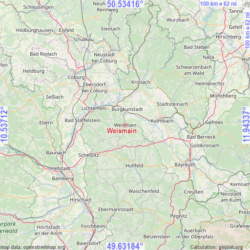
Weismain GPS coordinates[2]
50° 5' 6.432" North, 11° 14' 24.864" East
| Map corner | latitude | longitude |
|---|---|---|
| Upper-left | 50.53416°, | 10.53712° |
| Center: | 50.08512°, | 11.24024° |
| Lower-right: | 49.63184°, | 11.94337° |
| Map W x H: | 100.3×100.3 km | = 62.3×62.3mi |
| max Lat: | 55.01917° ⇑61.6% North |
| Weismain: | 50.08512° |
| min Lat: | ⇓38.4% South 47.40724° |
| min Long | Weismain | max Long |
| 5.92978° | 11.24024° | 14.98853° |
| W 70.5%⇐ | ⇒29.5% E |
Elevation
Elevation of Weismain is 318 m = 1043 ft, and this is 68.9 m = 226 ft above average elevation for this country.
| Max E: |
1256 m = 4121 ft | 35.5% |
| Weismain | 318 m 1043 ft | |
| Avg. | 249.1 m = 817 ft | |
Min E: |
-5 m = -16 ft | 64.5% |
See also: Germany elevation on elevation.city.
Geographical zone
Weismain is located in North temperate zone (between Tropic of Cancer and the Arctic Circle). Distance of this North polar circle is 1832.2 km =1138.5 mi to North.| Distance of | km | miles | from Weismain |
|---|---|---|---|
| North Pole | 4438.1 | 2757.7 | to North |
| Arctic Circle | 1832.2 | 1138.5 | to North |
| Tropic Cancer | 2963 | 1841.1 | to South |
| Equator | 5568.9 | 3460.4 | to South |


Nearby cities:
15 places around Weismain: (largest is in red/bold)
• Altendorf
5.2 km =3.2 mi,  268°
268°
• Altenkunstadt
4.5 km =2.8 mi,  9°
9°
• Burgkunstadt
6.3 km =3.9 mi, 7°
• Eckersdorf
12.8 km =8 mi,  119°
119°
• Hochstadt am Main
8.7 km =5.4 mi,  325°
325°
• Kasendorf
9.6 km =6 mi, 124°
• Kueps Oberfranken
12.2 km =7.6 mi, 12°
• Mainleus
9.9 km =6.2 mi,  80°
80°
• Marktgraitz
11.4 km =7.1 mi,  343°
343°
• Marktzeuln
10.5 km =6.5 mi, 330°
• Michelau
12.5 km =7.8 mi,  313°
313°
• Redwitz an der Rodach
10.1 km =6.3 mi,  346°
346°
• Stadelhofen
9.6 km =6 mi,  198°
198°
• Thurnau
12.8 km =8 mi, 121°
• Wattendorf
10 km =6.2 mi,  234°
234°
Sources, notices
• [Note1] Compared only with cities in Germany existing in our database
• [Src1] Map data: © OpenStreetMap contributors (CC-BY-SA)
• [Src2] Other city data from geonames.org with taken over terms of usage.
• [Src3] Geographical zone / Annual Mean Temperature by Robert A. Rohde @ Wikipedia
