Stadelhofen geodata
Stadelhofen (Bavaria) is a seat of a fourth-order administrative division; located in Germany in Europe/Berlin (GMT+2) time zone. With population of 1,264 people, there are 6405 cities with bigger population in this country. Compared to other cities in Germany, 63.6% of cities are located further ↑North; 69.9% of cities are located further ←West and 86.3% of cities have lower elevation than Stadelhofen. Note1
Administrative division(s):
- Level 1: Bavaria
- Level 2: Upper Franconia
- Level 3: Landkreis Bamberg
- Level 4: Stadelhofen


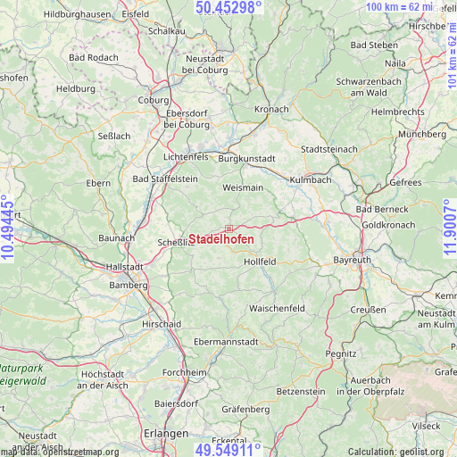
Stadelhofen GPS coordinates[2]
50° 0' 11.412" North, 11° 11' 51.252" East
| Map corner | latitude | longitude |
|---|---|---|
| Upper-left | 50.45298°, | 10.49445° |
| Center: | 50.00317°, | 11.19757° |
| Lower-right: | 49.54911°, | 11.9007° |
| Map W x H: | 100.5×100.5 km | = 62.4×62.4mi |
| max Lat: | 55.01917° ⇑63.6% North |
| Stadelhofen: | 50.00317° |
| min Lat: | ⇓36.4% South 47.40724° |
| min Long | Stadelhofen | max Long |
| 5.92978° | 11.19757° | 14.98853° |
| W 69.9%⇐ | ⇒30.1% E |
Elevation
Elevation of Stadelhofen is 480 m = 1575 ft, and this is 230.9 m = 758 ft above average elevation for this country.
| Max E: |
1256 m = 4121 ft | 13.7% |
| Stadelhofen | 480 m 1575 ft | |
| Avg. | 249.1 m = 817 ft | |
Min E: |
-5 m = -16 ft | 86.3% |
See also: Germany elevation on elevation.city.
Geographical zone
Stadelhofen is located in North temperate zone (between Tropic of Cancer and the Arctic Circle). Distance of this North polar circle is 1841.3 km =1144.1 mi to North.| Distance of | km | miles | from Stadelhofen |
|---|---|---|---|
| North Pole | 4447.2 | 2763.4 | to North |
| Arctic Circle | 1841.3 | 1144.1 | to North |
| Tropic Cancer | 2953.9 | 1835.5 | to South |
| Equator | 5559.8 | 3454.7 | to South |


Nearby cities:
15 places around Stadelhofen: (largest is in red/bold)
• Altendorf
9.3 km =5.8 mi,  346°
346°
• Altenkunstadt
14.1 km =8.8 mi,  15°
15°
• Aufseß
13.4 km =8.3 mi,  171°
171°
• Burgkunstadt
15.8 km =9.8 mi,  14°
14°
• Eckersdorf
14.5 km =9 mi,  78°
78°
• Heiligenstadt
15.7 km =9.8 mi,  186°
186°
• Hollfeld
9.9 km =6.2 mi,  137°
137°
• Kasendorf
11.6 km =7.2 mi,  71°
71°
• Königsfeld
6.8 km =4.2 mi,  200°
200°
• Poxdorf
9.2 km =5.7 mi,  216°
216°
• Scheßlitz
12.2 km =7.6 mi,  255°
255°
• Thurnau
14.2 km =8.8 mi, 79°
• Wattendorf
6.1 km =3.8 mi,  302°
302°
• Weismain
9.6 km =6 mi, 18°
• Wonsees
7.9 km =4.9 mi,  112°
112°
Sources, notices
• [Note1] Compared only with cities in Germany existing in our database
• [Src1] Map data: © OpenStreetMap contributors (CC-BY-SA)
• [Src2] Other city data from geonames.org with taken over terms of usage.
• [Src3] Geographical zone / Annual Mean Temperature by Robert A. Rohde @ Wikipedia
