Weihenzell geodata
Weihenzell (Bavaria) is a seat of a fourth-order administrative division; located in Germany in Europe/Berlin (GMT+2) time zone. With population of 2,829 people, there are 4145 cities with bigger population in this country. Compared to other cities in Germany, 78% of cities are located further ↑North; 61.1% of cities are located further ←West and 75.2% of cities have lower elevation than Weihenzell. Note1
Administrative division(s):
- Level 1: Bavaria
- Level 2: Regierungsbezirk Mittelfranken
- Level 3: Landkreis Ansbach
- Level 4: Weihenzell


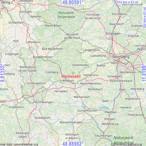
Weihenzell GPS coordinates[2]
49° 21' 0" North, 10° 37' 0.012" East
| Map corner | latitude | longitude |
|---|---|---|
| Upper-left | 49.80591°, | 9.91355° |
| Center: | 49.35°, | 10.61667° |
| Lower-right: | 48.88982°, | 11.3198° |
| Map W x H: | 101.9×101.9 km | = 63.3×63.3mi |
| max Lat: | 55.01917° ⇑78% North |
| Weihenzell: | 49.35° |
| min Lat: | ⇓22% South 47.40724° |
| min Long | Weihenzell | max Long |
| 5.92978° | 10.61667° | 14.98853° |
| W 61.1%⇐ | ⇒38.9% E |
Elevation
Elevation of Weihenzell is 399 m = 1309 ft, and this is 149.9 m = 492 ft above average elevation for this country.
| Max E: |
1256 m = 4121 ft | 24.8% |
| Weihenzell | 399 m 1309 ft | |
| Avg. | 249.1 m = 817 ft | |
Min E: |
-5 m = -16 ft | 75.2% |
See also: Germany elevation on elevation.city.
Geographical zone
Weihenzell is located in North temperate zone (between Tropic of Cancer and the Arctic Circle). Distance of this North polar circle is 1914 km =1189.3 mi to North.| Distance of | km | miles | from Weihenzell |
|---|---|---|---|
| North Pole | 4519.9 | 2808.5 | to North |
| Arctic Circle | 1914 | 1189.3 | to North |
| Tropic Cancer | 2881.3 | 1790.4 | to South |
| Equator | 5487.2 | 3409.6 | to South |


Nearby cities:
15 places around Weihenzell: (largest is in red/bold)
• Adelsdorf
14.3 km =8.9 mi,  20°
20°
• Ansbach
5.3 km =3.3 mi,  198°
198°
• Bruckberg
6.1 km =3.8 mi,  79°
79°
• Burgoberbach
13.2 km =8.2 mi,  190°
190°
• Dietenhofen
7.7 km =4.8 mi,  43°
43°
• Flachslanden
9.2 km =5.7 mi,  305°
305°
• Großhabersdorf
13.3 km =8.3 mi,  65°
65°
• Heilsbronn
12.5 km =7.8 mi,  97°
97°
• Lehrberg
7.7 km =4.8 mi,  266°
266°
• Neuendettelsau
14.2 km =8.8 mi,  121°
121°
• Neuhof an der Zenn
12.1 km =7.5 mi,  9°
9°
• Petersaurach
11.1 km =6.9 mi, 119°
• Rügland
6.1 km =3.8 mi,  336°
336°
• Sachsen
7.4 km =4.6 mi,  154°
154°
• Trautskirchen
12.1 km =7.5 mi,  352°
352°
Sources, notices
• [Note1] Compared only with cities in Germany existing in our database
• [Src1] Map data: © OpenStreetMap contributors (CC-BY-SA)
• [Src2] Other city data from geonames.org with taken over terms of usage.
• [Src3] Geographical zone / Annual Mean Temperature by Robert A. Rohde @ Wikipedia
