Ansbach geodata
Ansbach (Bavaria) is a seat of a second-order administrative division; located in Germany in Europe/Berlin (GMT+2) time zone. With population of 31,839 people, there are 435 cities with bigger population in this country. Compared to other cities in Germany, 78.6% of cities are located further ↑North; 60.6% of cities are located further ←West and 82.7% of cities have lower elevation than Ansbach. Note1
Administrative division(s):
- Level 1: Bavaria
- Level 2: Regierungsbezirk Mittelfranken
- Level 3: Kreisfreie Stadt Ansbach
- Level 4: Ansbach


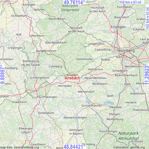
Ansbach GPS coordinates[2]
49° 18' 17.316" North, 10° 35' 35.16" East
| Map corner | latitude | longitude |
|---|---|---|
| Upper-left | 49.76114°, | 9.88997° |
| Center: | 49.30481°, | 10.5931° |
| Lower-right: | 48.84421°, | 11.29623° |
| Map W x H: | 102×102 km | = 63.4×63.4mi |
| max Lat: | 55.01917° ⇑78.6% North |
| Ansbach: | 49.30481° |
| min Lat: | ⇓21.4% South 47.40724° |
| min Long | Ansbach | max Long |
| 5.92978° | 10.5931° | 14.98853° |
| W 60.6%⇐ | ⇒39.4% E |
Elevation
Elevation of Ansbach is 451 m = 1480 ft, and this is 201.9 m = 662 ft above average elevation for this country.
| Max E: |
1256 m = 4121 ft | 17.3% |
| Ansbach | 451 m 1480 ft | |
| Avg. | 249.1 m = 817 ft | |
Min E: |
-5 m = -16 ft | 82.7% |
See also: Germany elevation on elevation.city.
Geographical zone
Ansbach is located in North temperate zone (between Tropic of Cancer and the Arctic Circle). Distance of this North polar circle is 1919 km =1192.4 mi to North.| Distance of | km | miles | from Ansbach |
|---|---|---|---|
| North Pole | 4524.9 | 2811.6 | to North |
| Arctic Circle | 1919 | 1192.4 | to North |
| Tropic Cancer | 2876.3 | 1787.2 | to South |
| Equator | 5482.2 | 3406.5 | to South |


Nearby cities:
15 places around Ansbach: (largest is in red/bold)
• Bruckberg
9.8 km =6.1 mi,  51°
51°
• Burgoberbach
8 km =5 mi,  185°
185°
• Dietenhofen
12.7 km =7.9 mi,  33°
33°
• Flachslanden
11.9 km =7.4 mi,  330°
330°
• Herrieden
9.9 km =6.2 mi,  221°
221°
• Lehrberg
7.5 km =4.7 mi,  307°
307°
• Leutershausen
13.2 km =8.2 mi,  267°
267°
• Merkendorf
13.8 km =8.6 mi,  144°
144°
• Neuendettelsau
14 km =8.7 mi,  99°
99°
• Petersaurach
11.4 km =7.1 mi,  92°
92°
• Rügland
10.6 km =6.6 mi,  356°
356°
• Sachsen
5.1 km =3.2 mi,  108°
108°
• Weidenbach
12.4 km =7.7 mi,  162°
162°
• Weihenzell
5.3 km =3.3 mi,  18°
18°
• Wolframs-Eschenbach
13.1 km =8.1 mi,  131°
131°
Sources, notices
• [Note1] Compared only with cities in Germany existing in our database
• [Src1] Map data: © OpenStreetMap contributors (CC-BY-SA)
• [Src2] Other city data from geonames.org with taken over terms of usage.
• [Src3] Geographical zone / Annual Mean Temperature by Robert A. Rohde @ Wikipedia
