Heilsbronn geodata
Heilsbronn (Bavaria) is a populated place; located in Germany in Europe/Berlin (GMT+2) time zone. With population of 9,374 people, there are 1726 cities with bigger population in this country. Compared to other cities in Germany, 78.1% of cities are located further ↑North; 63.9% of cities are located further ←West and 77.7% of cities have lower elevation than Heilsbronn. Note1
Administrative division(s):
- Level 1: Bavaria
- Level 2: Regierungsbezirk Mittelfranken
- Level 3: Landkreis Ansbach
- Level 4: Heilsbronn


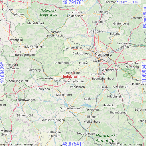
Heilsbronn GPS coordinates[2]
49° 20' 8.592" North, 10° 47' 14.676" East
| Map corner | latitude | longitude |
|---|---|---|
| Upper-left | 49.79176°, | 10.08429° |
| Center: | 49.33572°, | 10.78741° |
| Lower-right: | 48.87541°, | 11.49054° |
| Map W x H: | 101.9×101.9 km | = 63.3×63.3mi |
| max Lat: | 55.01917° ⇑78.1% North |
| Heilsbronn: | 49.33572° |
| min Lat: | ⇓21.9% South 47.40724° |
| min Long | Heilsbronn | max Long |
| 5.92978° | 10.78741° | 14.98853° |
| W 63.9%⇐ | ⇒36.1% E |
Elevation
Elevation of Heilsbronn is 417 m = 1368 ft, and this is 167.9 m = 551 ft above average elevation for this country.
| Max E: |
1256 m = 4121 ft | 22.3% |
| Heilsbronn | 417 m 1368 ft | |
| Avg. | 249.1 m = 817 ft | |
Min E: |
-5 m = -16 ft | 77.7% |
See also: Germany elevation on elevation.city.
Geographical zone
Heilsbronn is located in North temperate zone (between Tropic of Cancer and the Arctic Circle). Distance of this North polar circle is 1915.6 km =1190.3 mi to North.| Distance of | km | miles | from Heilsbronn |
|---|---|---|---|
| North Pole | 4521.4 | 2809.5 | to North |
| Arctic Circle | 1915.6 | 1190.3 | to North |
| Tropic Cancer | 2879.7 | 1789.4 | to South |
| Equator | 5485.6 | 3408.6 | to South |


Nearby cities:
15 places around Heilsbronn: (largest is in red/bold)
• Ammerndorf
10.7 km =6.6 mi,  24°
24°
• Bruckberg
6.9 km =4.3 mi,  292°
292°
• Cadolzburg
14.3 km =8.9 mi, 19°
• Dietenhofen
10.1 km =6.3 mi,  315°
315°
• Großhabersdorf
7.2 km =4.5 mi,  357°
357°
• Kammerstein
14.2 km =8.8 mi,  109°
109°
• Mitteleschenbach
13.8 km =8.6 mi,  176°
176°
• Neuendettelsau
5.8 km =3.6 mi, 182°
• Petersaurach
4.8 km =3 mi,  214°
214°
• Rohr
7.4 km =4.6 mi,  85°
85°
• Roßtal
9.9 km =6.2 mi,  47°
47°
• Sachsen
10.6 km =6.6 mi,  241°
241°
• Weihenzell
12.5 km =7.8 mi,  277°
277°
• Windsbach
10.2 km =6.3 mi,  163°
163°
• Wolframs-Eschenbach
12.9 km =8 mi,  199°
199°
Sources, notices
• [Note1] Compared only with cities in Germany existing in our database
• [Src1] Map data: © OpenStreetMap contributors (CC-BY-SA)
• [Src2] Other city data from geonames.org with taken over terms of usage.
• [Src3] Geographical zone / Annual Mean Temperature by Robert A. Rohde @ Wikipedia
