Flachslanden geodata
Flachslanden (Bavaria) is a populated place; located in Germany in Europe/Berlin (GMT+2) time zone. With population of 2,559 people, there are 4370 cities with bigger population in this country. Compared to other cities in Germany, 77.2% of cities are located further ↑North; 59.1% of cities are located further ←West and 84.5% of cities have lower elevation than Flachslanden. Note1
Administrative division(s):
- Level 1: Bavaria
- Level 2: Regierungsbezirk Mittelfranken
- Level 3: Landkreis Ansbach
- Level 4: Flachslanden, Markt


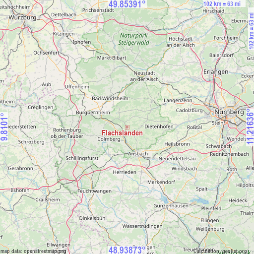
Flachslanden GPS coordinates[2]
49° 23' 54.42" North, 10° 30' 47.628" East
| Map corner | latitude | longitude |
|---|---|---|
| Upper-left | 49.85391°, | 9.8101° |
| Center: | 49.39845°, | 10.51323° |
| Lower-right: | 48.93873°, | 11.21636° |
| Map W x H: | 101.8×101.8 km | = 63.3×63.3mi |
| max Lat: | 55.01917° ⇑77.2% North |
| Flachslanden: | 49.39845° |
| min Lat: | ⇓22.8% South 47.40724° |
| min Long | Flachslanden | max Long |
| 5.92978° | 10.51323° | 14.98853° |
| W 59.1%⇐ | ⇒40.9% E |
Elevation
Elevation of Flachslanden is 465 m = 1526 ft, and this is 215.9 m = 708 ft above average elevation for this country.
| Max E: |
1256 m = 4121 ft | 15.5% |
| Flachslanden | 465 m 1526 ft | |
| Avg. | 249.1 m = 817 ft | |
Min E: |
-5 m = -16 ft | 84.5% |
See also: Germany elevation on elevation.city.
Geographical zone
Flachslanden is located in North temperate zone (between Tropic of Cancer and the Arctic Circle). Distance of this North polar circle is 1908.6 km =1185.9 mi to North.| Distance of | km | miles | from Flachslanden |
|---|---|---|---|
| North Pole | 4514.5 | 2805.2 | to North |
| Arctic Circle | 1908.6 | 1185.9 | to North |
| Tropic Cancer | 2886.7 | 1793.7 | to South |
| Equator | 5492.6 | 3412.9 | to South |


Nearby cities:
15 places around Flachslanden: (largest is in red/bold)
• Ansbach
11.9 km =7.4 mi,  150°
150°
• Bad Windsheim
13.6 km =8.5 mi,  328°
328°
• Bruckberg
14.1 km =8.8 mi,  107°
107°
• Colmberg
8.8 km =5.5 mi,  236°
236°
• Dietenhofen
12.8 km =8 mi,  89°
89°
• Illesheim
13.2 km =8.2 mi,  313°
313°
• Lehrberg
5.9 km =3.7 mi,  181°
181°
• Leutershausen
13.3 km =8.3 mi,  213°
213°
• Marktbergel
11.8 km =7.3 mi,  293°
293°
• Neuhof an der Zenn
11.6 km =7.2 mi,  55°
55°
• Oberdachstetten
6.1 km =3.8 mi, 289°
• Obernzenn
6.8 km =4.2 mi, 330°
• Rügland
5.1 km =3.2 mi, 88°
• Trautskirchen
8.8 km =5.5 mi,  41°
41°
• Weihenzell
9.2 km =5.7 mi,  125°
125°
Sources, notices
• [Note1] Compared only with cities in Germany existing in our database
• [Src1] Map data: © OpenStreetMap contributors (CC-BY-SA)
• [Src2] Other city data from geonames.org with taken over terms of usage.
• [Src3] Geographical zone / Annual Mean Temperature by Robert A. Rohde @ Wikipedia
