Warstein geodata
Warstein (North Rhine-Westphalia) is a populated place; located in Germany in Europe/Berlin (GMT+2) time zone. With population of 28,532 people, there are 492 cities with bigger population in this country. Compared to other cities in Germany, 65.5% of cities are located further ↓South; 72.4% of cities are located further →East and 68.4% of cities have lower elevation than Warstein. Note1
Administrative division(s):
- Level 1: North Rhine-Westphalia
- Level 2: Regierungsbezirk Arnsberg
- Level 3: Kreis Soest
- Level 4: Warstein


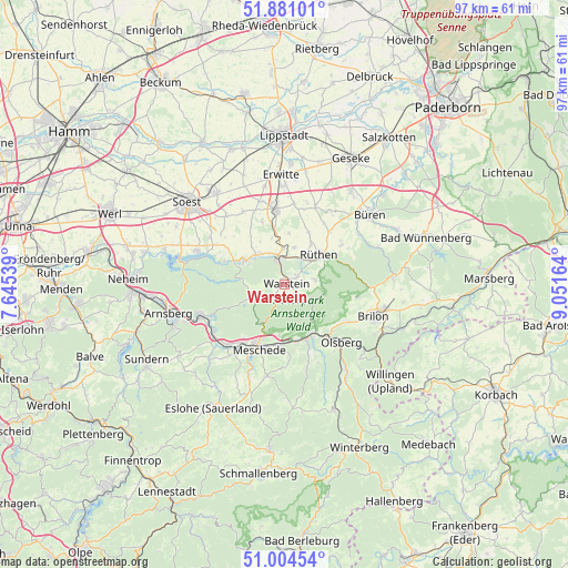
Warstein GPS coordinates[2]
51° 26' 41.568" North, 8° 20' 54.636" East
| Map corner | latitude | longitude |
|---|---|---|
| Upper-left | 51.88101°, | 7.64539° |
| Center: | 51.44488°, | 8.34851° |
| Lower-right: | 51.00454°, | 9.05164° |
| Map W x H: | 97.5×97.5 km | = 60.6×60.6mi |
| max Lat: | 55.01917° ⇑34.5% North |
| Warstein: | 51.44488° |
| min Lat: | ⇓65.5% South 47.40724° |
| min Long | Warstein | max Long |
| 5.92978° | 8.34851° | 14.98853° |
| W 27.6%⇐ | ⇒72.4% E |
Elevation
Elevation of Warstein is 346 m = 1135 ft, and this is 96.9 m = 318 ft above average elevation for this country.
| Max E: |
1256 m = 4121 ft | 31.6% |
| Warstein | 346 m 1135 ft | |
| Avg. | 249.1 m = 817 ft | |
Min E: |
-5 m = -16 ft | 68.4% |
See also: Germany elevation on elevation.city.
Geographical zone
Warstein is located in North temperate zone (between Tropic of Cancer and the Arctic Circle). Distance of this North polar circle is 1681 km =1044.5 mi to North.| Distance of | km | miles | from Warstein |
|---|---|---|---|
| North Pole | 4286.9 | 2663.8 | to North |
| Arctic Circle | 1681 | 1044.5 | to North |
| Tropic Cancer | 3114.2 | 1935.1 | to South |
| Equator | 5720.1 | 3554.3 | to South |


Nearby cities:
15 places around Warstein: (largest is in red/bold)
• Altenbüren
12.7 km =7.9 mi,  120°
120°
• Anröchte
13.6 km =8.5 mi,  355°
355°
• Arnsberg
19.6 km =12.2 mi,  249°
249°
• Bad Sassendorf
19.9 km =12.4 mi,  320°
320°
• Bestwig
10 km =6.2 mi,  158°
158°
• Brilon
16.4 km =10.2 mi,  109°
109°
• Büren
18.8 km =11.7 mi,  51°
51°
• Erwitte
18.7 km =11.6 mi, 357°
• Eslohe
24.6 km =15.3 mi,  210°
210°
• Geseke
24.5 km =15.2 mi,  27°
27°
• Meschede
11.5 km =7.1 mi,  203°
203°
• Möhnesee
16.1 km =10 mi,  292°
292°
• Olsberg
13.9 km =8.6 mi,  135°
135°
• Rüthen
7.9 km =4.9 mi, 49°
• Soest
22.2 km =13.8 mi,  310°
310°
Sources, notices
• [Note1] Compared only with cities in Germany existing in our database
• [Src1] Map data: © OpenStreetMap contributors (CC-BY-SA)
• [Src2] Other city data from geonames.org with taken over terms of usage.
• [Src3] Geographical zone / Annual Mean Temperature by Robert A. Rohde @ Wikipedia
