Bad Sassendorf geodata
Bad Sassendorf (North Rhine-Westphalia) is a seat of a fourth-order administrative division; located in Germany in Europe/Berlin (GMT+2) time zone. With population of 11,659 people, there are 1410 cities with bigger population in this country. Compared to other cities in Germany, 67.3% of cities are located further ↓South; 74.6% of cities are located further →East and 69.7% of cities have higher elevation than Bad Sassendorf. Note1
Administrative division(s):
- Level 1: North Rhine-Westphalia
- Level 2: Regierungsbezirk Arnsberg
- Level 3: Kreis Soest
- Level 4: Bad Sassendorf


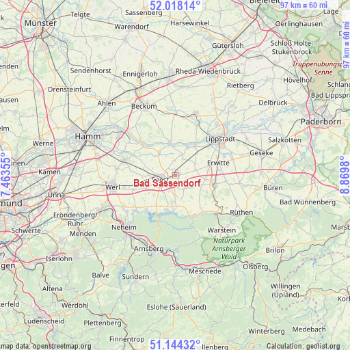
Bad Sassendorf GPS coordinates[2]
51° 34' 59.988" North, 8° 10' 0.012" East
| Map corner | latitude | longitude |
|---|---|---|
| Upper-left | 52.01814°, | 7.46355° |
| Center: | 51.58333°, | 8.16667° |
| Lower-right: | 51.14432°, | 8.8698° |
| Map W x H: | 97.2×97.2 km | = 60.4×60.4mi |
| max Lat: | 55.01917° ⇑32.7% North |
| Bad Sassendorf: | 51.58333° |
| min Lat: | ⇓67.3% South 47.40724° |
| min Long | Bad Sassendorf | max Long |
| 5.92978° | 8.16667° | 14.98853° |
| W 25.4%⇐ | ⇒74.6% E |
Elevation
Elevation of Bad Sassendorf is 93 m = 305 ft, and this is 156.1 m = 512 ft below average elevation for this country.
| Max E: |
1256 m = 4121 ft | 69.7% |
| Avg. | 249.1 m = 817 ft | |
| Bad Sassendorf | 93 m = 305 ft | |
Min E: |
-5 m = -16 ft | 30.3% |
See also: Germany elevation on elevation.city.
Geographical zone
Bad Sassendorf is located in North temperate zone (between Tropic of Cancer and the Arctic Circle). Distance of this North polar circle is 1665.6 km =1035 mi to North.| Distance of | km | miles | from Bad Sassendorf |
|---|---|---|---|
| North Pole | 4271.5 | 2654.2 | to North |
| Arctic Circle | 1665.6 | 1035 | to North |
| Tropic Cancer | 3129.6 | 1944.6 | to South |
| Equator | 5735.5 | 3563.9 | to South |


Nearby cities:
15 places around Bad Sassendorf: (largest is in red/bold)
• Anröchte
11.7 km =7.3 mi,  99°
99°
• Arnsberg
23 km =14.3 mi,  194°
194°
• Beckum
21 km =13 mi,  335°
335°
• Erwitte
12.3 km =7.6 mi,  74°
74°
• Geseke
24.6 km =15.3 mi, 74°
• Langenberg
23.4 km =14.5 mi,  26°
26°
• Lippstadt
15.9 km =9.9 mi,  50°
50°
• Möhnesee
9.5 km =5.9 mi, 193°
• Rüthen
21.3 km =13.2 mi,  118°
118°
• Soest
4.3 km =2.7 mi,  258°
258°
• Wadersloh
17.6 km =10.9 mi,  19°
19°
• Warstein
19.9 km =12.4 mi,  140°
140°
• Welver
14.3 km =8.9 mi,  285°
285°
• Werl
17.7 km =11 mi, 259°
• Wickede
22.9 km =14.2 mi,  245°
245°
Sources, notices
• [Note1] Compared only with cities in Germany existing in our database
• [Src1] Map data: © OpenStreetMap contributors (CC-BY-SA)
• [Src2] Other city data from geonames.org with taken over terms of usage.
• [Src3] Geographical zone / Annual Mean Temperature by Robert A. Rohde @ Wikipedia
