Freinsheim geodata
Freinsheim (Rheinland-Pfalz) is a populated place; located in Germany in Europe/Berlin (GMT+2) time zone. With population of 4,989 people, there are 2833 cities with bigger population in this country. Compared to other cities in Germany, 75.6% of cities are located further ↑North; 73.9% of cities are located further →East and 65.4% of cities have higher elevation than Freinsheim. Note1
Administrative division(s):
- Level 1: Rheinland-Pfalz
- Level 3: Landkreis Bad Dürkheim
- Level 4: Freinsheim


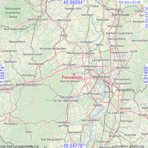
Freinsheim GPS coordinates[2]
49° 30' 23.364" North, 8° 12' 42.696" East
| Map corner | latitude | longitude |
|---|---|---|
| Upper-left | 49.96094°, | 7.50874° |
| Center: | 49.50649°, | 8.21186° |
| Lower-right: | 49.04778°, | 8.91499° |
| Map W x H: | 101.5×101.5 km | = 63.1×63.1mi |
| max Lat: | 55.01917° ⇑75.6% North |
| Freinsheim: | 49.50649° |
| min Lat: | ⇓24.4% South 47.40724° |
| min Long | Freinsheim | max Long |
| 5.92978° | 8.21186° | 14.98853° |
| W 26.1%⇐ | ⇒73.9% E |
Elevation
Elevation of Freinsheim is 118 m = 387 ft, and this is 131.1 m = 430 ft below average elevation for this country.
| Max E: |
1256 m = 4121 ft | 65.4% |
| Avg. | 249.1 m = 817 ft | |
| Freinsheim | 118 m = 387 ft | |
Min E: |
-5 m = -16 ft | 34.6% |
See also: Germany elevation on elevation.city.
Geographical zone
Freinsheim is located in North temperate zone (between Tropic of Cancer and the Arctic Circle). Distance of this North polar circle is 1896.6 km =1178.5 mi to North.| Distance of | km | miles | from Freinsheim |
|---|---|---|---|
| North Pole | 4502.5 | 2797.7 | to North |
| Arctic Circle | 1896.6 | 1178.5 | to North |
| Tropic Cancer | 2898.7 | 1801.2 | to South |
| Equator | 5504.6 | 3420.4 | to South |


Nearby cities:
15 places around Freinsheim: (largest is in red/bold)
• Bad Dürkheim
5.7 km =3.5 mi,  209°
209°
• Birkenheide
4.6 km =2.9 mi,  127°
127°
• Bissersheim
3.3 km =2.1 mi,  350°
350°
• Bobenheim am Berg
4.8 km =3 mi,  294°
294°
• Dackenheim
2.4 km =1.5 mi,  312°
312°
• Erpolzheim
2.1 km =1.3 mi,  154°
154°
• Großkarlbach
3.7 km =2.3 mi,  14°
14°
• Herxheim am Berg
2.4 km =1.5 mi,  277°
277°
• Kallstadt
3.1 km =1.9 mi,  236°
236°
• Kirchheim an der Weinstraße
4.1 km =2.5 mi,  326°
326°
• Kleinkarlbach
5.7 km =3.5 mi, 308°
• Lambsheim
5.5 km =3.4 mi,  81°
81°
• Laumersheim
5.6 km =3.5 mi,  17°
17°
• Weisenheim am Berg
4.2 km =2.6 mi, 279°
• Weisenheim am Sand
2.9 km =1.8 mi,  63°
63°
Sources, notices
• [Note1] Compared only with cities in Germany existing in our database
• [Src1] Map data: © OpenStreetMap contributors (CC-BY-SA)
• [Src2] Other city data from geonames.org with taken over terms of usage.
• [Src3] Geographical zone / Annual Mean Temperature by Robert A. Rohde @ Wikipedia
