Lawitz geodata
Lawitz (Brandenburg) is a seat of a fourth-order administrative division; located in Germany in Europe/Berlin (GMT+2) time zone. With population of 680 people, there are 8420 cities with bigger population in this country. Compared to other cities in Germany, 73.1% of cities are located further ↓South; 99.6% of cities are located further ←West and 83.2% of cities have higher elevation than Lawitz. Note1


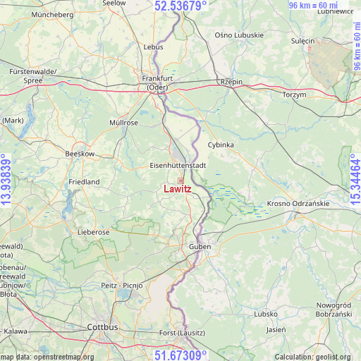
Lawitz GPS coordinates[2]
52° 6' 25.308" North, 14° 38' 29.436" East
| Map corner | latitude | longitude |
|---|---|---|
| Upper-left | 52.53679°, | 13.93839° |
| Center: | 52.10703°, | 14.64151° |
| Lower-right: | 51.67309°, | 15.34464° |
| Map W x H: | 96×96 km | = 59.7×59.7mi |
| max Lat: | 55.01917° ⇑26.9% North |
| Lawitz: | 52.10703° |
| min Lat: | ⇓73.1% South 47.40724° |
| min Long | Lawitz | max Long |
| 5.92978° | 14.64151° | 14.98853° |
| W 99.6%⇐ | ⇒0.40000000000001% E |
Elevation
Elevation of Lawitz is 39 m = 128 ft, and this is 210.1 m = 689 ft below average elevation for this country.
| Max E: |
1256 m = 4121 ft | 83.2% |
| Avg. | 249.1 m = 817 ft | |
| Lawitz | 39 m = 128 ft | |
Min E: |
-5 m = -16 ft | 16.8% |
See also: Germany elevation on elevation.city.
Geographical zone
Lawitz is located in North temperate zone (between Tropic of Cancer and the Arctic Circle). Distance of this North polar circle is 1607.4 km =998.8 mi to North.| Distance of | km | miles | from Lawitz |
|---|---|---|---|
| North Pole | 4213.3 | 2618 | to North |
| Arctic Circle | 1607.4 | 998.8 | to North |
| Tropic Cancer | 3187.8 | 1980.8 | to South |
| Equator | 5793.8 | 3600.1 | to South |


Nearby cities:
15 places around Lawitz: (largest is in red/bold)
• Brieskow-Finkenheerd
17 km =10.6 mi,  344°
344°
• Eisenhüttenstadt
4.8 km =3 mi,  6°
6°
• Friedland
25.8 km =16 mi,  269°
269°
• Groß Lindow
15.9 km =9.9 mi,  332°
332°
• Guben
18.2 km =11.3 mi,  164°
164°
• Jamlitz
23.1 km =14.4 mi,  236°
236°
• Lieberose
27 km =16.8 mi, 239°
• Mixdorf
19.5 km =12.1 mi,  302°
302°
• Müllrose
21.8 km =13.5 mi,  315°
315°
• Neuzelle
1.9 km =1.2 mi,  166°
166°
• Schenkendöbern
16.7 km =10.4 mi,  181°
181°
• Tauer
26.5 km =16.5 mi,  209°
209°
• Vogelsang
8.5 km =5.3 mi, 10°
• Wiesenau
14.2 km =8.8 mi,  345°
345°
• Ziltendorf
11.1 km =6.9 mi, 353°
Sources, notices
• [Note1] Compared only with cities in Germany existing in our database
• [Src1] Map data: © OpenStreetMap contributors (CC-BY-SA)
• [Src2] Other city data from geonames.org with taken over terms of usage.
• [Src3] Geographical zone / Annual Mean Temperature by Robert A. Rohde @ Wikipedia
