Venningen geodata
Venningen (Rheinland-Pfalz) is a seat of a fourth-order administrative division; located in Germany in Europe/Berlin (GMT+2) time zone. With population of 956 people, there are 7323 cities with bigger population in this country. Compared to other cities in Germany, 79% of cities are located further ↑North; 74.4% of cities are located further →East and 62.3% of cities have higher elevation than Venningen. Note1
Administrative division(s):
- Level 1: Rheinland-Pfalz
- Level 3: Landkreis Südliche Weinstraße
- Level 4: Venningen


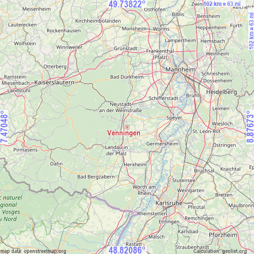
Venningen GPS coordinates[2]
49° 16' 54.012" North, 8° 10' 24.996" East
| Map corner | latitude | longitude |
|---|---|---|
| Upper-left | 49.73822°, | 7.47048° |
| Center: | 49.28167°, | 8.17361° |
| Lower-right: | 48.82086°, | 8.87673° |
| Map W x H: | 102×102 km | = 63.4×63.4mi |
| max Lat: | 55.01917° ⇑79% North |
| Venningen: | 49.28167° |
| min Lat: | ⇓21% South 47.40724° |
| min Long | Venningen | max Long |
| 5.92978° | 8.17361° | 14.98853° |
| W 25.6%⇐ | ⇒74.4% E |
Elevation
Elevation of Venningen is 136 m = 446 ft, and this is 113.1 m = 371 ft below average elevation for this country.
| Max E: |
1256 m = 4121 ft | 62.3% |
| Avg. | 249.1 m = 817 ft | |
| Venningen | 136 m = 446 ft | |
Min E: |
-5 m = -16 ft | 37.7% |
See also: Germany elevation on elevation.city.
Geographical zone
Venningen is located in North temperate zone (between Tropic of Cancer and the Arctic Circle). Distance of this North polar circle is 1921.6 km =1194 mi to North.| Distance of | km | miles | from Venningen |
|---|---|---|---|
| North Pole | 4527.5 | 2813.3 | to North |
| Arctic Circle | 1921.6 | 1194 | to North |
| Tropic Cancer | 2873.7 | 1785.6 | to South |
| Equator | 5479.6 | 3404.9 | to South |


Nearby cities:
15 places around Venningen: (largest is in red/bold)
• Altdorf
3.1 km =1.9 mi,  78°
78°
• Böbingen
4.6 km =2.9 mi,  86°
86°
• Edenkoben
3.4 km =2.1 mi,  274°
274°
• Edesheim
3.5 km =2.2 mi,  233°
233°
• Essingen
5.1 km =3.2 mi,  179°
179°
• Freimersheim
3.9 km =2.4 mi,  109°
109°
• Großfischlingen
1.4 km =0.9 mi,  171°
171°
• Hochstadt
4.6 km =2.9 mi,  146°
146°
• Kirrweiler
2.3 km =1.4 mi,  340°
340°
• Kleinfischlingen
2.3 km =1.4 mi, 154°
• Knöringen
5.3 km =3.3 mi,  203°
203°
• Maikammer
4 km =2.5 mi,  310°
310°
• Rhodt unter Rietburg
5 km =3.1 mi,  254°
254°
• Roschbach
5.6 km =3.5 mi, 225°
• Sankt Martin
5.4 km =3.4 mi,  292°
292°
Sources, notices
• [Note1] Compared only with cities in Germany existing in our database
• [Src1] Map data: © OpenStreetMap contributors (CC-BY-SA)
• [Src2] Other city data from geonames.org with taken over terms of usage.
• [Src3] Geographical zone / Annual Mean Temperature by Robert A. Rohde @ Wikipedia
