Vallendar geodata
Vallendar (Rheinland-Pfalz) is a populated place; located in Germany in Europe/Berlin (GMT+2) time zone. With population of 8,959 people, there are 1797 cities with bigger population in this country. Compared to other cities in Germany, 54.7% of cities are located further ↑North; 84.5% of cities are located further →East and 58% of cities have higher elevation than Vallendar. Note1
Administrative division(s):
- Level 1: Rheinland-Pfalz
- Level 3: Landkreis Mayen-Koblenz
- Level 4: Vallendar


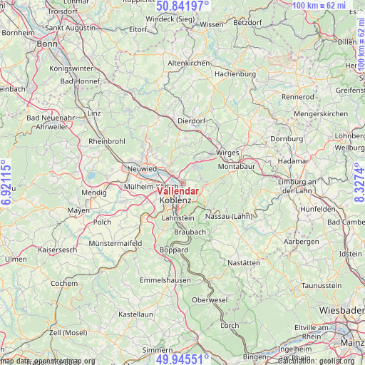
Vallendar GPS coordinates[2]
50° 23' 45.096" North, 7° 37' 27.372" East
| Map corner | latitude | longitude |
|---|---|---|
| Upper-left | 50.84197°, | 6.92115° |
| Center: | 50.39586°, | 7.62427° |
| Lower-right: | 49.94551°, | 8.3274° |
| Map W x H: | 99.7×99.7 km | = 62×62mi |
| max Lat: | 55.01917° ⇑54.7% North |
| Vallendar: | 50.39586° |
| min Lat: | ⇓45.3% South 47.40724° |
| min Long | Vallendar | max Long |
| 5.92978° | 7.62427° | 14.98853° |
| W 15.5%⇐ | ⇒84.5% E |
Elevation
Elevation of Vallendar is 168 m = 551 ft, and this is 81.1 m = 266 ft below average elevation for this country.
| Max E: |
1256 m = 4121 ft | 58% |
| Avg. | 249.1 m = 817 ft | |
| Vallendar | 168 m = 551 ft | |
Min E: |
-5 m = -16 ft | 42% |
See also: Germany elevation on elevation.city.
Geographical zone
Vallendar is located in North temperate zone (between Tropic of Cancer and the Arctic Circle). Distance of this North polar circle is 1797.7 km =1117 mi to North.| Distance of | km | miles | from Vallendar |
|---|---|---|---|
| North Pole | 4403.6 | 2736.3 | to North |
| Arctic Circle | 1797.7 | 1117 | to North |
| Tropic Cancer | 2997.6 | 1862.6 | to South |
| Equator | 5603.5 | 3481.9 | to South |


Nearby cities:
15 places around Vallendar: (largest is in red/bold)
• Bendorf
4.4 km =2.7 mi,  313°
313°
• Eitelborn
7.3 km =4.5 mi,  105°
105°
• Hillscheid
5.4 km =3.4 mi,  77°
77°
• Höhr-Grenzhausen
5.4 km =3.4 mi,  36°
36°
• Kaltenengers
5.7 km =3.5 mi,  293°
293°
• Koblenz
5.7 km =3.5 mi,  214°
214°
• Miellen
7.6 km =4.7 mi,  156°
156°
• Nauort
7.9 km =4.9 mi,  4°
4°
• Neuhäusel
6.2 km =3.9 mi,  102°
102°
• Niederwerth
0.7 km =0.4 mi, 310°
• Sankt Sebastian
4.7 km =2.9 mi, 290°
• Simmern
3.6 km =2.2 mi, 101°
• Stromberg
7.1 km =4.4 mi,  346°
346°
• Urbar
1.5 km =0.9 mi, 155°
• Weitersburg
2.9 km =1.8 mi,  323°
323°
Sources, notices
• [Note1] Compared only with cities in Germany existing in our database
• [Src1] Map data: © OpenStreetMap contributors (CC-BY-SA)
• [Src2] Other city data from geonames.org with taken over terms of usage.
• [Src3] Geographical zone / Annual Mean Temperature by Robert A. Rohde @ Wikipedia
