Kaltenengers geodata
Kaltenengers (Rheinland-Pfalz) is a seat of a fourth-order administrative division; located in Germany in Europe/Berlin (GMT+2) time zone. With population of 1,932 people, there are 5165 cities with bigger population in this country. Compared to other cities in Germany, 54.4% of cities are located further ↑North; 86.1% of cities are located further →East and 74.1% of cities have higher elevation than Kaltenengers. Note1
Administrative division(s):
- Level 1: Rheinland-Pfalz
- Level 3: Landkreis Mayen-Koblenz
- Level 4: Kaltenengers


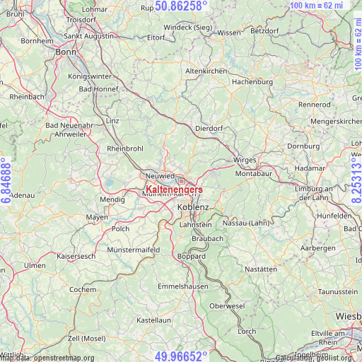
Kaltenengers GPS coordinates[2]
50° 25' 0.012" North, 7° 33' 0" East
| Map corner | latitude | longitude |
|---|---|---|
| Upper-left | 50.86258°, | 6.84688° |
| Center: | 50.41667°, | 7.55° |
| Lower-right: | 49.96652°, | 8.25313° |
| Map W x H: | 99.6×99.6 km | = 61.9×61.9mi |
| max Lat: | 55.01917° ⇑54.4% North |
| Kaltenengers: | 50.41667° |
| min Lat: | ⇓45.6% South 47.40724° |
| min Long | Kaltenengers | max Long |
| 5.92978° | 7.55° | 14.98853° |
| W 13.9%⇐ | ⇒86.1% E |
Elevation
Elevation of Kaltenengers is 67 m = 220 ft, and this is 182.1 m = 597 ft below average elevation for this country.
| Max E: |
1256 m = 4121 ft | 74.1% |
| Avg. | 249.1 m = 817 ft | |
| Kaltenengers | 67 m = 220 ft | |
Min E: |
-5 m = -16 ft | 25.9% |
See also: Germany elevation on elevation.city.
Geographical zone
Kaltenengers is located in North temperate zone (between Tropic of Cancer and the Arctic Circle). Distance of this North polar circle is 1795.4 km =1115.6 mi to North.| Distance of | km | miles | from Kaltenengers |
|---|---|---|---|
| North Pole | 4401.3 | 2734.8 | to North |
| Arctic Circle | 1795.4 | 1115.6 | to North |
| Tropic Cancer | 2999.9 | 1864.1 | to South |
| Equator | 5605.8 | 3483.3 | to South |


Nearby cities:
15 places around Kaltenengers: (largest is in red/bold)
• Bendorf
2.2 km =1.4 mi,  71°
71°
• Caan
7.3 km =4.5 mi,  40°
40°
• Heimbach
3.9 km =2.4 mi,  342°
342°
• Kettig
6.2 km =3.9 mi,  252°
252°
• Koblenz
7.3 km =4.5 mi,  163°
163°
• Mülheim-Kärlich
5 km =3.1 mi,  225°
225°
• Neuwied
5.9 km =3.7 mi,  288°
288°
• Niederwerth
5.1 km =3.2 mi,  111°
111°
• Sankt Sebastian
1.1 km =0.7 mi,  128°
128°
• Stromberg
5.8 km =3.6 mi, 37°
• Urbar
7 km =4.3 mi,  122°
122°
• Urmitz
2.4 km =1.5 mi,  270°
270°
• Vallendar
5.7 km =3.5 mi, 113°
• Weitersburg
3.5 km =2.2 mi,  90°
90°
• Weißenthurm
7 km =4.3 mi, 270°
Sources, notices
• [Note1] Compared only with cities in Germany existing in our database
• [Src1] Map data: © OpenStreetMap contributors (CC-BY-SA)
• [Src2] Other city data from geonames.org with taken over terms of usage.
• [Src3] Geographical zone / Annual Mean Temperature by Robert A. Rohde @ Wikipedia
