Untermünkheim geodata
Untermünkheim (Baden-Württemberg) is a seat of a fourth-order administrative division; located in Germany in Europe/Berlin (GMT+2) time zone. With population of 3,019 people, there are 3982 cities with bigger population in this country. Compared to other cities in Germany, 81% of cities are located further ↑North; 53.8% of cities are located further →East and 55.9% of cities have lower elevation than Untermünkheim. Note1
Administrative division(s):
- Level 1: Baden-Württemberg
- Level 2: Regierungsbezirk Stuttgart
- Level 3: Landkreis Schwäbisch Hall
- Level 4: Untermünkheim


Untermünkheim GPS coordinates[2]
49° 9' 9.18" North, 9° 44' 1.824" East
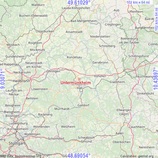
| Map corner | latitude | longitude |
|---|---|---|
| Upper-left | 49.61029°, | 9.03071° |
| Center: | 49.15255°, | 9.73384° |
| Lower-right: | 48.69054°, | 10.43697° |
| Map W x H: | 102.3×102.3 km | = 63.6×63.6mi |
| max Lat: | 55.01917° ⇑81% North |
| Untermünkheim: | 49.15255° |
| min Lat: | ⇓19% South 47.40724° |
| min Long | Untermünkheim | max Long |
| 5.92978° | 9.73384° | 14.98853° |
| W 46.2%⇐ | ⇒53.8% E |
Elevation
Elevation of Untermünkheim is 265 m = 869 ft, and this is 15.9 m = 52 ft above average elevation for this country.
| Max E: |
1256 m = 4121 ft | 44.1% |
| Untermünkheim | 265 m 869 ft | |
| Avg. | 249.1 m = 817 ft | |
Min E: |
-5 m = -16 ft | 55.9% |
See also: Germany elevation on elevation.city.
Geographical zone
Untermünkheim is located in North temperate zone (between Tropic of Cancer and the Arctic Circle). Distance of this North polar circle is 1935.9 km =1202.9 mi to North.| Distance of | km | miles | from Untermünkheim |
|---|---|---|---|
| North Pole | 4541.8 | 2822.1 | to North |
| Arctic Circle | 1935.9 | 1202.9 | to North |
| Tropic Cancer | 2859.3 | 1776.7 | to South |
| Equator | 5465.3 | 3396 | to South |


Nearby cities:
15 places around Untermünkheim: (largest is in red/bold)
• Braunsbach
6.6 km =4.1 mi,  38°
38°
• Ilshofen
13.6 km =8.5 mi,  81°
81°
• Kupferzell
9 km =5.6 mi,  339°
339°
• Künzelsau
14.8 km =9.2 mi,  345°
345°
• Langenburg
14.4 km =8.9 mi, 38°
• Mainhardt
15.5 km =9.6 mi,  236°
236°
• Michelbach an der Bilz
9.4 km =5.8 mi,  167°
167°
• Michelfeld
7.3 km =4.5 mi,  213°
213°
• Neuenstein
12.6 km =7.8 mi,  297°
297°
• Oberrot
16.1 km =10 mi,  197°
197°
• Obersontheim
16.1 km =10 mi,  131°
131°
• Schwäbisch Hall
4.6 km =2.9 mi,  175°
175°
• Vellberg
13 km =8.1 mi, 125°
• Waldenburg
7.7 km =4.8 mi, 297°
• Wolpertshausen
8.2 km =5.1 mi, 78°
Sources, notices
• [Note1] Compared only with cities in Germany existing in our database
• [Src1] Map data: © OpenStreetMap contributors (CC-BY-SA)
• [Src2] Other city data from geonames.org with taken over terms of usage.
• [Src3] Geographical zone / Annual Mean Temperature by Robert A. Rohde @ Wikipedia
