Senden geodata
Senden (Bavaria) is a populated place; located in Germany in Europe/Berlin (GMT+2) time zone. With population of 22,275 people, there are 678 cities with bigger population in this country. Compared to other cities in Germany, 91% of cities are located further ↑North; 50.8% of cities are located further ←West and 87.2% of cities have lower elevation than Senden. Note1
Administrative division(s):
- Level 1: Bavaria
- Level 2: Swabia
- Level 3: Landkreis Neu-Ulm
- Level 4: Senden


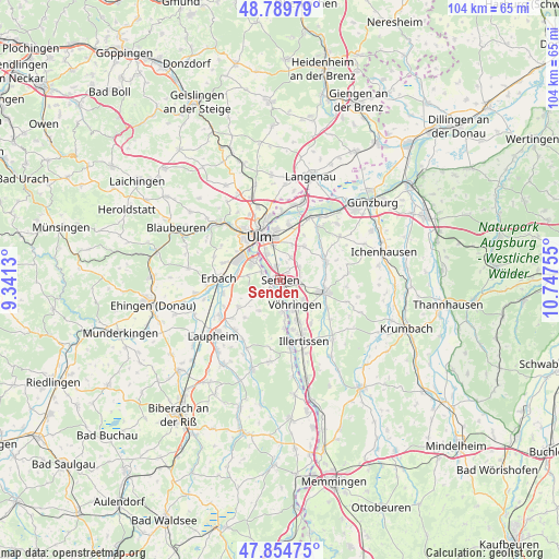
Senden GPS coordinates[2]
48° 19' 27.876" North, 10° 2' 39.912" East
| Map corner | latitude | longitude |
|---|---|---|
| Upper-left | 48.78979°, | 9.3413° |
| Center: | 48.32441°, | 10.04442° |
| Lower-right: | 47.85475°, | 10.74755° |
| Map W x H: | 104×104 km | = 64.6×64.6mi |
| max Lat: | 55.01917° ⇑91% North |
| Senden: | 48.32441° |
| min Lat: | ⇓9% South 47.40724° |
| min Long | Senden | max Long |
| 5.92978° | 10.04442° | 14.98853° |
| W 50.8%⇐ | ⇒49.2% E |
Elevation
Elevation of Senden is 487 m = 1598 ft, and this is 237.9 m = 781 ft above average elevation for this country.
| Max E: |
1256 m = 4121 ft | 12.8% |
| Senden | 487 m 1598 ft | |
| Avg. | 249.1 m = 817 ft | |
Min E: |
-5 m = -16 ft | 87.2% |
See also: Germany elevation on elevation.city.
Geographical zone
Senden is located in North temperate zone (between Tropic of Cancer and the Arctic Circle). Distance of this North polar circle is 2028 km =1260.1 mi to North.| Distance of | km | miles | from Senden |
|---|---|---|---|
| North Pole | 4633.9 | 2879.4 | to North |
| Arctic Circle | 2028 | 1260.1 | to North |
| Tropic Cancer | 2767.3 | 1719.5 | to South |
| Equator | 5373.2 | 3338.8 | to South |


Nearby cities:
15 places around Senden: (largest is in red/bold)
• Bellenberg
8.2 km =5.1 mi,  155°
155°
• Dietenheim
12.8 km =8 mi,  170°
170°
• Erbach
11.6 km =7.2 mi,  272°
272°
• Holzheim
7.7 km =4.8 mi,  32°
32°
• Hüttisheim
9 km =5.6 mi,  236°
236°
• Illerrieden
6.1 km =3.8 mi,  175°
175°
• Illertissen
12.1 km =7.5 mi, 158°
• Nersingen
12.9 km =8 mi, 26°
• Neu-Ulm
8 km =5 mi,  342°
342°
• Pfaffenhofen an der Roth
9.3 km =5.8 mi,  68°
68°
• Schnürpflingen
6.9 km =4.3 mi,  213°
213°
• Staig
4.8 km =3 mi, 235°
• Ulm
9.1 km =5.7 mi,  334°
334°
• Vöhringen
5.8 km =3.6 mi,  151°
151°
• Weißenhorn
8.8 km =5.5 mi,  104°
104°
Sources, notices
• [Note1] Compared only with cities in Germany existing in our database
• [Src1] Map data: © OpenStreetMap contributors (CC-BY-SA)
• [Src2] Other city data from geonames.org with taken over terms of usage.
• [Src3] Geographical zone / Annual Mean Temperature by Robert A. Rohde @ Wikipedia
