Pfaffenhofen an der Roth geodata
Pfaffenhofen an der Roth (Bavaria) is a populated place; located in Germany in Europe/Berlin (GMT+2) time zone. With population of 7,158 people, there are 2151 cities with bigger population in this country. Compared to other cities in Germany, 90.7% of cities are located further ↑North; 52.7% of cities are located further ←West and 87.3% of cities have lower elevation than Pfaffenhofen an der Roth. Note1
Administrative division(s):
- Level 1: Bavaria
- Level 2: Swabia
- Level 3: Landkreis Neu-Ulm
- Level 4: Pfaffenhofen a.d.Roth, Markt
Current local time in Pfaffenhofen an der Roth:
02:42 PM, TuesdayDifference from your time zone: hours


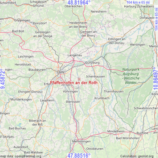
Pfaffenhofen an der Roth GPS coordinates[2]
48° 21' 16.344" North, 10° 9' 42.624" East
| Map corner | latitude | longitude |
|---|---|---|
| Upper-left | 48.81964°, | 9.45872° |
| Center: | 48.35454°, | 10.16184° |
| Lower-right: | 47.88516°, | 10.86497° |
| Map W x H: | 103.9×103.9 km | = 64.6×64.6mi |
| max Lat: | 55.01917° ⇑90.7% North |
| Pfaffenhofen an der Roth: | 48.35454° |
| min Lat: | ⇓9.3% South 47.40724° |
| min Long | Pfaffenhofen an | max Long |
| 5.92978° | 10.16184° | 14.98853° |
| W 52.7%⇐ | ⇒47.3% E |
Elevation
Elevation of Pfaffenhofen an der Roth is 488 m = 1601 ft, and this is 238.9 m = 784 ft above average elevation for this country.
| Max E: |
1256 m = 4121 ft | 12.7% |
| Pfaffenhofen an der Roth | 488 m 1601 ft | |
| Avg. | 249.1 m = 817 ft | |
Min E: |
-5 m = -16 ft | 87.3% |
See also: Germany elevation on elevation.city.
Geographical zone
Pfaffenhofen an der Roth is located in North temperate zone (between Tropic of Cancer and the Arctic Circle). Distance of this North polar circle is 2024.7 km =1258.1 mi to North.| Distance of | km | miles | from Pfaffenhofen an der Roth |
|---|---|---|---|
| North Pole | 4630.5 | 2877.3 | to North |
| Arctic Circle | 2024.7 | 1258.1 | to North |
| Tropic Cancer | 2770.6 | 1721.6 | to South |
| Equator | 5376.5 | 3340.8 | to South |


Nearby cities:
15 places around Pfaffenhofen an der Roth: (largest is in red/bold)
• Bellenberg
12 km =7.5 mi,  205°
205°
• Bubesheim
10.9 km =6.8 mi,  36°
36°
• Ellzee
11.7 km =7.3 mi,  98°
98°
• Holzheim
5.6 km =3.5 mi,  305°
305°
• Ichenhausen
10.9 km =6.8 mi,  80°
80°
• Illerrieden
12.4 km =7.7 mi,  221°
221°
• Leipheim
11.5 km =7.1 mi,  22°
22°
• Nersingen
8.7 km =5.4 mi,  340°
340°
• Neu-Ulm
11.9 km =7.4 mi,  290°
290°
• Rieden an der Kötz
7.8 km =4.8 mi,  64°
64°
• Roggenburg
10.1 km =6.3 mi,  149°
149°
• Senden
9.3 km =5.8 mi,  248°
248°
• Vöhringen
10.3 km =6.4 mi, 214°
• Waldstetten
9.8 km =6.1 mi,  94°
94°
• Weißenhorn
5.5 km =3.4 mi,  181°
181°
Sources, notices
• [Note1] Compared only with cities in Germany existing in our database
• [Src1] Map data: © OpenStreetMap contributors (CC-BY-SA)
• [Src2] Other city data from geonames.org with taken over terms of usage.
• [Src3] Geographical zone / Annual Mean Temperature by Robert A. Rohde @ Wikipedia
