Tuningen geodata
Tuningen (Baden-Württemberg) is a seat of a fourth-order administrative division; located in Germany in Europe/Berlin (GMT+2) time zone. With population of 2,870 people, there are 4124 cities with bigger population in this country. Compared to other cities in Germany, 95.1% of cities are located further ↑North; 70.2% of cities are located further →East and 98.8% of cities have lower elevation than Tuningen. Note1
Administrative division(s):
- Level 1: Baden-Württemberg
- Level 2: Freiburg Region
- Level 3: Schwarzwald-Baar-Kreis
- Level 4: Tuningen


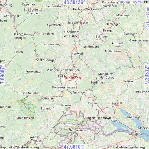
Tuningen GPS coordinates[2]
48° 1' 59.988" North, 8° 36' 0" East
| Map corner | latitude | longitude |
|---|---|---|
| Upper-left | 48.50136°, | 7.89687° |
| Center: | 48.03333°, | 8.6° |
| Lower-right: | 47.56101°, | 9.30312° |
| Map W x H: | 104.6×104.6 km | = 65×65mi |
| max Lat: | 55.01917° ⇑95.1% North |
| Tuningen: | 48.03333° |
| min Lat: | ⇓4.9% South 47.40724° |
| min Long | Tuningen | max Long |
| 5.92978° | 8.6° | 14.98853° |
| W 29.8%⇐ | ⇒70.2% E |
Elevation
Elevation of Tuningen is 759 m = 2490 ft, and this is 509.9 m = 1673 ft above average elevation for this country.
| Max E: |
1256 m = 4121 ft | 1.2% |
| Tuningen | 759 m 2490 ft | |
| Avg. | 249.1 m = 817 ft | |
Min E: |
-5 m = -16 ft | 98.8% |
See also: Germany elevation on elevation.city.
Geographical zone
Tuningen is located in North temperate zone (between Tropic of Cancer and the Arctic Circle). Distance of this North polar circle is 2060.4 km =1280.3 mi to North.| Distance of | km | miles | from Tuningen |
|---|---|---|---|
| North Pole | 4666.3 | 2899.5 | to North |
| Arctic Circle | 2060.4 | 1280.3 | to North |
| Tropic Cancer | 2734.9 | 1699.4 | to South |
| Equator | 5340.8 | 3318.6 | to South |


Nearby cities:
15 places around Tuningen: (largest is in red/bold)
• Aldingen
10.5 km =6.5 mi,  45°
45°
• Bad Dürrheim
5.3 km =3.3 mi,  255°
255°
• Dauchingen
7.3 km =4.5 mi,  329°
329°
• Deißlingen
8.8 km =5.5 mi,  3°
3°
• Donaueschingen
11.6 km =7.2 mi,  221°
221°
• Durchhausen
5.6 km =3.5 mi,  82°
82°
• Gunningen
7.7 km =4.8 mi, 75°
• Hausen ob Verena
9.5 km =5.9 mi, 76°
• Niedereschach
12.2 km =7.6 mi,  335°
335°
• Rietheim-Weilheim
12.5 km =7.8 mi,  98°
98°
• Seitingen-Oberflacht
8.9 km =5.5 mi, 102°
• Spaichingen
11 km =6.8 mi,  65°
65°
• Talheim
5.3 km =3.3 mi,  110°
110°
• Trossingen
5.8 km =3.6 mi,  34°
34°
• Villingen-Schwenningen
8.5 km =5.3 mi,  292°
292°
Sources, notices
• [Note1] Compared only with cities in Germany existing in our database
• [Src1] Map data: © OpenStreetMap contributors (CC-BY-SA)
• [Src2] Other city data from geonames.org with taken over terms of usage.
• [Src3] Geographical zone / Annual Mean Temperature by Robert A. Rohde @ Wikipedia
