Bad Dürrheim geodata
Bad Dürrheim (Baden-Württemberg) is a populated place; located in Germany in Europe/Berlin (GMT+2) time zone. With population of 12,829 people, there are 1261 cities with bigger population in this country. Compared to other cities in Germany, 95.2% of cities are located further ↑North; 70.8% of cities are located further →East and 97.8% of cities have lower elevation than Bad Dürrheim. Note1
Administrative division(s):
- Level 1: Baden-Württemberg
- Level 2: Freiburg Region
- Level 3: Schwarzwald-Baar-Kreis
- Level 4: Bad Dürrheim


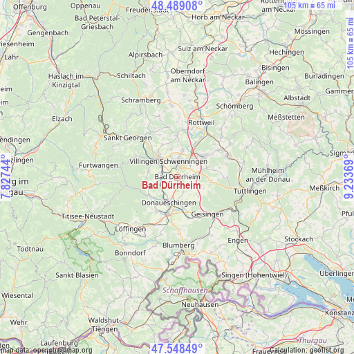
Bad Dürrheim GPS coordinates[2]
48° 1' 15.348" North, 8° 31' 50.016" East
| Map corner | latitude | longitude |
|---|---|---|
| Upper-left | 48.48908°, | 7.82744° |
| Center: | 48.02093°, | 8.53056° |
| Lower-right: | 47.54849°, | 9.23369° |
| Map W x H: | 104.6×104.6 km | = 65×65mi |
| max Lat: | 55.01917° ⇑95.2% North |
| Bad Dürrheim: | 48.02093° |
| min Lat: | ⇓4.8% South 47.40724° |
| min Long | Bad Dürrheim | max Long |
| 5.92978° | 8.53056° | 14.98853° |
| W 29.2%⇐ | ⇒70.8% E |
Elevation
Elevation of Bad Dürrheim is 700 m = 2297 ft, and this is 450.9 m = 1479 ft above average elevation for this country.
| Max E: |
1256 m = 4121 ft | 2.2% |
| Bad Dürrheim | 700 m 2297 ft | |
| Avg. | 249.1 m = 817 ft | |
Min E: |
-5 m = -16 ft | 97.8% |
See also: Germany elevation on elevation.city.
Geographical zone
Bad Dürrheim is located in North temperate zone (between Tropic of Cancer and the Arctic Circle). Distance of this North polar circle is 2061.7 km =1281.1 mi to North.| Distance of | km | miles | from Bad Dürrheim |
|---|---|---|---|
| North Pole | 4667.6 | 2900.3 | to North |
| Arctic Circle | 2061.7 | 1281.1 | to North |
| Tropic Cancer | 2733.5 | 1698.5 | to South |
| Equator | 5339.4 | 3317.7 | to South |


Nearby cities:
15 places around Bad Dürrheim: (largest is in red/bold)
• Bräunlingen
11.9 km =7.4 mi,  211°
211°
• Dauchingen
7.8 km =4.8 mi,  10°
10°
• Deißlingen
11.7 km =7.3 mi,  29°
29°
• Donaueschingen
7.7 km =4.8 mi,  198°
198°
• Durchhausen
10.9 km =6.8 mi,  78°
78°
• Geisingen
13.9 km =8.6 mi,  140°
140°
• Gunningen
13 km =8.1 mi, 75°
• Hüfingen
11.1 km =6.9 mi, 196°
• Mönchweiler
12 km =7.5 mi,  317°
317°
• Niedereschach
12.5 km =7.8 mi,  0°
0°
• Seitingen-Oberflacht
13.8 km =8.6 mi,  91°
91°
• Talheim
10.1 km =6.3 mi, 92°
• Trossingen
10.5 km =6.5 mi,  53°
53°
• Tuningen
5.3 km =3.3 mi, 75°
• Villingen-Schwenningen
5.4 km =3.4 mi,  329°
329°
Sources, notices
• [Note1] Compared only with cities in Germany existing in our database
• [Src1] Map data: © OpenStreetMap contributors (CC-BY-SA)
• [Src2] Other city data from geonames.org with taken over terms of usage.
• [Src3] Geographical zone / Annual Mean Temperature by Robert A. Rohde @ Wikipedia
