Tülau geodata
Tülau (Lower Saxony) is a seat of a fourth-order administrative division; located in Germany in Europe/Berlin (GMT+2) time zone. With population of 1,494 people, there are 5892 cities with bigger population in this country. Compared to other cities in Germany, 78.4% of cities are located further ↓South; 65.2% of cities are located further ←West and 72.4% of cities have higher elevation than Tülau. Note1


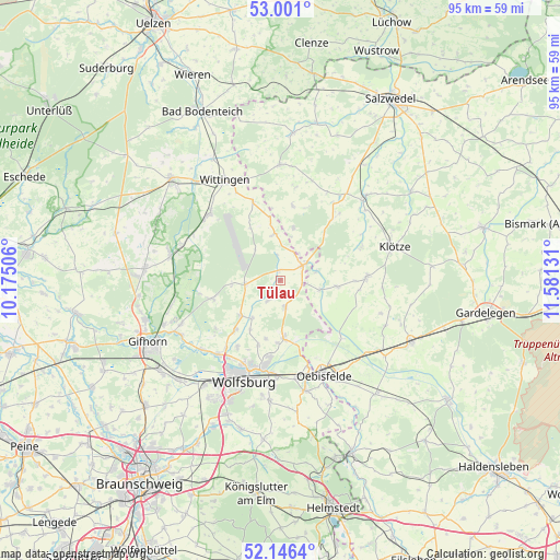
Tülau GPS coordinates[2]
52° 34' 32.808" North, 10° 52' 41.448" East
| Map corner | latitude | longitude |
|---|---|---|
| Upper-left | 53.001°, | 10.17506° |
| Center: | 52.57578°, | 10.87818° |
| Lower-right: | 52.1464°, | 11.58131° |
| Map W x H: | 95×95 km | = 59×59mi |
| max Lat: | 55.01917° ⇑21.6% North |
| Tülau: | 52.57578° |
| min Lat: | ⇓78.4% South 47.40724° |
| min Long | Tülau | max Long |
| 5.92978° | 10.87818° | 14.98853° |
| W 65.2%⇐ | ⇒34.8% E |
Elevation
Elevation of Tülau is 75 m = 246 ft, and this is 174.1 m = 571 ft below average elevation for this country.
| Max E: |
1256 m = 4121 ft | 72.4% |
| Avg. | 249.1 m = 817 ft | |
| Tülau | 75 m = 246 ft | |
Min E: |
-5 m = -16 ft | 27.6% |
See also: Germany elevation on elevation.city.
Geographical zone
Tülau is located in North temperate zone (between Tropic of Cancer and the Arctic Circle). Distance of this North polar circle is 1555.3 km =966.4 mi to North.| Distance of | km | miles | from Tülau |
|---|---|---|---|
| North Pole | 4161.2 | 2585.6 | to North |
| Arctic Circle | 1555.3 | 966.4 | to North |
| Tropic Cancer | 3240 | 2013.2 | to South |
| Equator | 5845.9 | 3632.5 | to South |


Nearby cities:
15 places around Tülau: (largest is in red/bold)
• Barwedel
9.2 km =5.7 mi,  229°
229°
• Bergfeld
4.2 km =2.6 mi,  212°
212°
• Bokensdorf
13.8 km =8.6 mi, 232°
• Brome
4.8 km =3 mi,  55°
55°
• Grafhorst
15.2 km =9.4 mi,  162°
162°
• Immekath
14.8 km =9.2 mi,  67°
67°
• Jahrstedt
6.9 km =4.3 mi,  104°
104°
• Jembke
11.3 km =7 mi,  221°
221°
• Jübar
12.8 km =8 mi,  9°
9°
• Kunrau
9.5 km =5.9 mi, 95°
• Kusey
14.4 km =8.9 mi,  88°
88°
• Parsau
4.6 km =2.9 mi,  169°
169°
• Rühen
10 km =6.2 mi,  176°
176°
• Tappenbeck
14.9 km =9.3 mi, 218°
• Tiddische
8.4 km =5.2 mi, 218°
Sources, notices
• [Note1] Compared only with cities in Germany existing in our database
• [Src1] Map data: © OpenStreetMap contributors (CC-BY-SA)
• [Src2] Other city data from geonames.org with taken over terms of usage.
• [Src3] Geographical zone / Annual Mean Temperature by Robert A. Rohde @ Wikipedia
