Grafhorst geodata
Grafhorst (Lower Saxony) is a seat of a fourth-order administrative division; located in Germany in Europe/Berlin (GMT+2) time zone. With population of 1,046 people, there are 7020 cities with bigger population in this country. Compared to other cities in Germany, 76.8% of cities are located further ↓South; 66.2% of cities are located further ←West and 75.5% of cities have higher elevation than Grafhorst. Note1


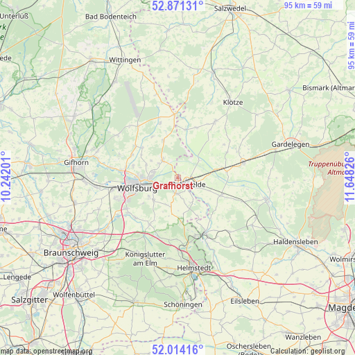
Grafhorst GPS coordinates[2]
52° 26' 41.352" North, 10° 56' 42.468" East
| Map corner | latitude | longitude |
|---|---|---|
| Upper-left | 52.87131°, | 10.24201° |
| Center: | 52.44482°, | 10.94513° |
| Lower-right: | 52.01416°, | 11.64826° |
| Map W x H: | 95.3×95.3 km | = 59.2×59.2mi |
| max Lat: | 55.01917° ⇑23.2% North |
| Grafhorst: | 52.44482° |
| min Lat: | ⇓76.8% South 47.40724° |
| min Long | Grafhorst | max Long |
| 5.92978° | 10.94513° | 14.98853° |
| W 66.2%⇐ | ⇒33.8% E |
Elevation
Elevation of Grafhorst is 61 m = 200 ft, and this is 188.1 m = 617 ft below average elevation for this country.
| Max E: |
1256 m = 4121 ft | 75.5% |
| Avg. | 249.1 m = 817 ft | |
| Grafhorst | 61 m = 200 ft | |
Min E: |
-5 m = -16 ft | 24.5% |
See also: Germany elevation on elevation.city.
Geographical zone
Grafhorst is located in North temperate zone (between Tropic of Cancer and the Arctic Circle). Distance of this North polar circle is 1569.9 km =975.5 mi to North.| Distance of | km | miles | from Grafhorst |
|---|---|---|---|
| North Pole | 4175.7 | 2594.7 | to North |
| Arctic Circle | 1569.9 | 975.5 | to North |
| Tropic Cancer | 3225.4 | 2004.2 | to South |
| Equator | 5831.3 | 3623.4 | to South |


Nearby cities:
15 places around Grafhorst: (largest is in red/bold)
• Bahrdorf
7.6 km =4.7 mi,  150°
150°
• Bergfeld
12.9 km =8 mi,  328°
328°
• Danndorf
3.1 km =1.9 mi,  224°
224°
• Groß Twülpstedt
8.1 km =5 mi,  192°
192°
• Jahrstedt
13 km =8.1 mi,  9°
9°
• Miesterhorst
13.4 km =8.3 mi,  82°
82°
• Oebisfelde
3.1 km =1.9 mi,  112°
112°
• Parsau
10.7 km =6.6 mi,  339°
339°
• Querenhorst
12.5 km =7.8 mi,  173°
173°
• Rothenfelde
10.5 km =6.5 mi,  259°
259°
• Rätzlingen
12.4 km =7.7 mi, 112°
• Rühen
6 km =3.7 mi,  318°
318°
• Tiddische
12.7 km =7.9 mi,  309°
309°
• Velpke
4.1 km =2.5 mi, 188°
• Wolfsburg
11.3 km =7 mi, 258°
Sources, notices
• [Note1] Compared only with cities in Germany existing in our database
• [Src1] Map data: © OpenStreetMap contributors (CC-BY-SA)
• [Src2] Other city data from geonames.org with taken over terms of usage.
• [Src3] Geographical zone / Annual Mean Temperature by Robert A. Rohde @ Wikipedia
