Treuenbrietzen geodata
Treuenbrietzen (Brandenburg) is a populated place; located in Germany in Europe/Berlin (GMT+2) time zone. With population of 8,675 people, there are 1848 cities with bigger population in this country. Compared to other cities in Germany, 73% of cities are located further ↓South; 91.3% of cities are located further ←West and 75.3% of cities have higher elevation than Treuenbrietzen. Note1
Administrative division(s):
- Level 1: Brandenburg
- Level 3: Landkreis Potsdam-Mittelmark
- Level 4: Treuenbrietzen


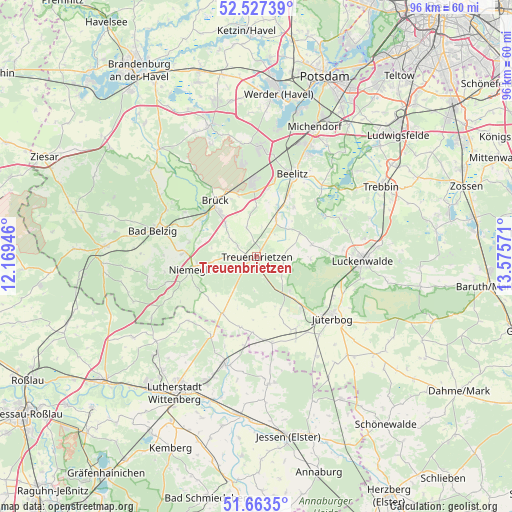
Treuenbrietzen GPS coordinates[2]
52° 5' 51.144" North, 12° 52' 21.288" East
| Map corner | latitude | longitude |
|---|---|---|
| Upper-left | 52.52739°, | 12.16946° |
| Center: | 52.09754°, | 12.87258° |
| Lower-right: | 51.6635°, | 13.57571° |
| Map W x H: | 96.1×96.1 km | = 59.7×59.7mi |
| max Lat: | 55.01917° ⇑27% North |
| Treuenbrietzen: | 52.09754° |
| min Lat: | ⇓73% South 47.40724° |
| min Long | Treuenbrietzen | max Long |
| 5.92978° | 12.87258° | 14.98853° |
| W 91.3%⇐ | ⇒8.7% E |
Elevation
Elevation of Treuenbrietzen is 62 m = 203 ft, and this is 187.1 m = 614 ft below average elevation for this country.
| Max E: |
1256 m = 4121 ft | 75.3% |
| Avg. | 249.1 m = 817 ft | |
| Treuenbrietzen | 62 m = 203 ft | |
Min E: |
-5 m = -16 ft | 24.7% |
See also: Germany elevation on elevation.city.
Geographical zone
Treuenbrietzen is located in North temperate zone (between Tropic of Cancer and the Arctic Circle). Distance of this North polar circle is 1608.5 km =999.5 mi to North.| Distance of | km | miles | from Treuenbrietzen |
|---|---|---|---|
| North Pole | 4214.4 | 2618.7 | to North |
| Arctic Circle | 1608.5 | 999.5 | to North |
| Tropic Cancer | 3186.8 | 1980.2 | to South |
| Equator | 5792.7 | 3599.4 | to South |


Nearby cities:
15 places around Treuenbrietzen: (largest is in red/bold)
• Bad Belzig
19.7 km =12.2 mi,  284°
284°
• Beelitz
17 km =10.6 mi,  23°
23°
• Borkheide
13.3 km =8.3 mi,  353°
353°
• Borkwalde
17.2 km =10.7 mi, 351°
• Boßdorf
17.6 km =10.9 mi,  226°
226°
• Brück
13.2 km =8.2 mi,  327°
327°
• Fichtenwalde
20.3 km =12.6 mi,  2°
2°
• Jüterbog
18.1 km =11.2 mi,  128°
128°
• Kropstädt
17.3 km =10.7 mi,  210°
210°
• Linthe
8.4 km =5.2 mi,  313°
313°
• Luckenwalde
20.2 km =12.6 mi,  92°
92°
• Mochau
22.7 km =14.1 mi,  215°
215°
• Niedergörsdorf
15.2 km =9.4 mi,  149°
149°
• Niemegk
12.8 km =8 mi,  258°
258°
• Zahna
21.2 km =13.2 mi,  196°
196°
Sources, notices
• [Note1] Compared only with cities in Germany existing in our database
• [Src1] Map data: © OpenStreetMap contributors (CC-BY-SA)
• [Src2] Other city data from geonames.org with taken over terms of usage.
• [Src3] Geographical zone / Annual Mean Temperature by Robert A. Rohde @ Wikipedia
