Thelkow geodata
Thelkow (Mecklenburg-Vorpommern) is a populated place; located in Germany in Europe/Berlin (GMT+2) time zone. With population of 514 people, there are 9299 cities with bigger population in this country. Compared to other cities in Germany, 93.1% of cities are located further ↓South; 88.5% of cities are located further ←West and 81% of cities have higher elevation than Thelkow. Note1
Administrative division(s):
- Level 1: Mecklenburg-Vorpommern
- Level 3: Landkreis Rostock
- Level 4: Thelkow


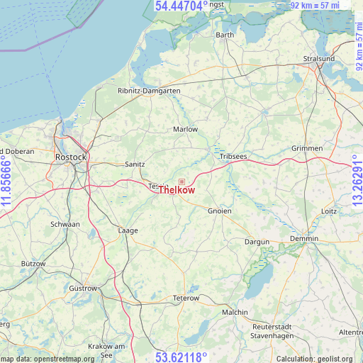
Thelkow GPS coordinates[2]
54° 2' 10.176" North, 12° 33' 35.208" East
| Map corner | latitude | longitude |
|---|---|---|
| Upper-left | 54.44704°, | 11.85666° |
| Center: | 54.03616°, | 12.55978° |
| Lower-right: | 53.62118°, | 13.26291° |
| Map W x H: | 91.8×91.8 km | = 57×57mi |
| max Lat: | 55.01917° ⇑6.9% North |
| Thelkow: | 54.03616° |
| min Lat: | ⇓93.1% South 47.40724° |
| min Long | Thelkow | max Long |
| 5.92978° | 12.55978° | 14.98853° |
| W 88.5%⇐ | ⇒11.5% E |
Elevation
Elevation of Thelkow is 44 m = 144 ft, and this is 205.1 m = 673 ft below average elevation for this country.
| Max E: |
1256 m = 4121 ft | 81% |
| Avg. | 249.1 m = 817 ft | |
| Thelkow | 44 m = 144 ft | |
Min E: |
-5 m = -16 ft | 19% |
See also: Germany elevation on elevation.city.
Geographical zone
Thelkow is located in North temperate zone (between Tropic of Cancer and the Arctic Circle). Distance of this North polar circle is 1392.9 km =865.5 mi to North.| Distance of | km | miles | from Thelkow |
|---|---|---|---|
| North Pole | 3998.8 | 2484.7 | to North |
| Arctic Circle | 1392.9 | 865.5 | to North |
| Tropic Cancer | 3402.3 | 2114.1 | to South |
| Equator | 6008.3 | 3733.4 | to South |


Nearby cities:
15 places around Thelkow: (largest is in red/bold)
• Bad Sülze
10.6 km =6.6 mi,  38°
38°
• Behren-Lübchin
6.9 km =4.3 mi,  96°
96°
• Cammin
14.1 km =8.8 mi,  248°
248°
• Deyelsdorf
17.1 km =10.6 mi,  86°
86°
• Eixen
17.6 km =10.9 mi, 37°
• Gnoien
12.4 km =7.7 mi,  127°
127°
• Jördenstorf
17.9 km =11.1 mi,  168°
168°
• Lieblingshof
15.1 km =9.4 mi,  267°
267°
• Marlow
13.2 km =8.2 mi,  3°
3°
• Selpin
6.5 km =4 mi,  219°
219°
• Semlow
17.3 km =10.7 mi,  21°
21°
• Tessin
6.2 km =3.9 mi,  261°
261°
• Tribsees
14.5 km =9 mi,  62°
62°
• Walkendorf
9.4 km =5.8 mi,  183°
183°
• Wardow
15.4 km =9.6 mi, 220°
Sources, notices
• [Note1] Compared only with cities in Germany existing in our database
• [Src1] Map data: © OpenStreetMap contributors (CC-BY-SA)
• [Src2] Other city data from geonames.org with taken over terms of usage.
• [Src3] Geographical zone / Annual Mean Temperature by Robert A. Rohde @ Wikipedia
